chapter 13, part 2 overview - phys.ufl.edu · 1 chapter 13, part 2 upper-air support overview •...
TRANSCRIPT
1
Chapter 13, Part 2
Upper-Air Support
Overview
• Last time: how do middle latitude cyclones form?• Today: when (why) do they form?
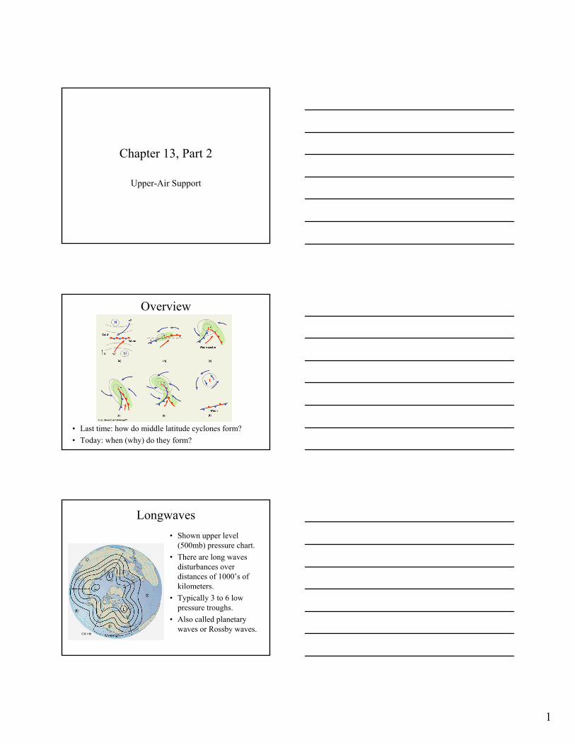
Longwaves• Shown upper level
(500mb) pressure chart.• There are long waves
disturbances over distances of 1000’s of kilometers.
• Typically 3 to 6 low pressure troughs.
• Also called planetary waves or Rossby waves.

2
Shortwaves
• Imbedded in the longwaves are shortwaves.
Motion of Shortwaves
• Shortwave move faster than long waves.• Shortwaves deepen around a low pressure trough.
Barotropic and Baroclinic
• Barotropic – contour lines (&wind) parallel to isotherms• Baroclinic – contour lines (&wind) cross isotherms (1&3)

3
Warm and Cold Advection• Cold advection – transport of cold air by the
wind from colder to warmer regions.• Warm advection – transport of warm air by
the wind from warmer to colder regions.• On the previous slide,
– cold advection to the west of pressure troughs– warm advection to the east of pressure troughs.
• Adding cold air will raise the surface pressure, while adding warm air will lower it.
Baroclinic Instability
• If a shortwave moves into a region near the polar front just west of a frontal wave, it will enhance the low at the center of the frontal wave and the high in the cold region.
Upper-Air Support
• Cold air convergence strengthens the surface cold high.
• Warm air divergence strengthens the surface low.
• Both act to intensify the cyclone.

4
Upper Level Winds after Occulusion
• Warm surface air is cut-off and surface low fills in.
• Shown: vertically stacked surface and upper level lows.
• Wind flows around upper level lows, which may remain stationary for many days.
Polar Front Jet Stream
• Remember, the polar front jet forms at the polar front where there are sharp temperature and pressure differences.
• The wind speeds in the jet stream are high.
Jet Streak
• A region of maximum wind speeds in the jet stream is called a jet streak.
• There is strong convergence before (to the west) of the jet streak and strong divergence after (to the east) of it.

5
Role of Jet Stream
• Convergence (C) and divergence (D) near the jet streak intensify surface highs (H) and lows (L) and help drive the storm.
Jet Stream Air Support
• Without upper-level support the storm gradually dies out.• In winter polar front and jet stream are in US, while in
summer they are in Canada (Alberta and NWT).
Summary Wave Cyclone Development

6
Conveyor Belt Model• Snowstorms along east
coast of US.• Warm conveyor starts in
warm sector.• Cold conveyor starts
from the ocean and is forced upwards near L.
• Dry conveyor belt descends from behind cold front. A branch can sweep in creating a “comma” cloud.
The March Storm of 1993
• Shown: color enhanced infrared satellite image from March 13, 1993. Note comma clouds.
Surface Weather Map for March 13
• Open wave cyclone centered in north Florida.• Ahead of cold front, head thunderstorms (squall
line) pound Florida with heavy rain, high winds, and tornadoes.
Pressure at low is 975 mb, whichis very low.

7
500 mb Weather Map for March 13
• A low pressure trough exists west of the surface low.• Wind and contour lines cross isotherms near the low
pressure trough – baroclinic atmosphere.
Development of March 13 Storm
• Frontal wave off of Texas coast at 7AM, 3/12.• Open wave centered in N. Florida at 4AM, 3/13.• Occluded front over Virginia at 4PM, 3/13.
Note low is 960 mb, pressure similar to category 3 hurricane.
Winds of 125 mph measured on Mt. Washington, NH.
Summary
• Upper level air support is needed for a middle latitude cyclone to develop.
• Upper level winds and pressure are determined by both long and short waves.
• A low pressure trough above and to the west of a surface low causes– converging cold air to strengthen the high– diverging warm air to strengthen the low.