

Canada
Ottawa
W
E
N
S
km 0 500250
mi 0 500250

USA Capitals
80°W 75°W50°N 70°W
25°N
30°N
35°N
40°N
45°N
85°W90°W95°W100°W105°W110°W115°W120°W125°W
Tropic of Cancer
Lake Superior
Lake
M
ichi
gan
Lake Huron Lake Erie
Lake Ontario
ATLANTICOCEAN
Gulf ofMexico
PACIFICOCEAN
W
E
N
S
20°N
22°N
160°W 156°W60°N
70°N
50°N 160°W 140°W
BeringSea
Gulf of Alaska
250 500
250 500
0mi
0km
100 200
100 200
0mi
0km
National boundaryState boundaryNational capitalState capital
LEGEND
125 250
125 250
0mi
0km

Canada Physical Map Unit 5: Canada and the United States
1. Label the following bodies of water on your map. Outline the river systems in BLUE.
a. Hudson Bay b. Atlantic Ocean c. Labrador Sea d. Davis Strait e. Baffin Bay f. Beaufort Sea g. Bering Sea h. Pacific Ocean i. Arctic Ocean j. Hudson Strait k. Gulf of Alaska l. Mackenzie River m. St. Lawrence River
2. Label the following mountain ranges and color them BROWN.
a. Rocky Mountains b. Mackenzie Mountains c. Coast Mountains
3. Label the following plains and color them GREEN.
a. Interior Plains b. Hudson Bay lowlands
4. Label the following islands and peninsulas and color them YELLOW.
a. Labrador Peninsula b. Ungava Peninsula c. Baffin Island d. Victoria Island
5. Label the United States and Greenland

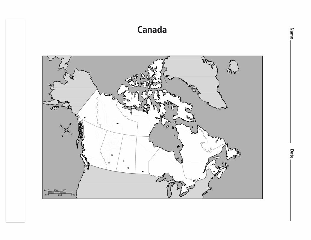
Canada Political Map Unit 5: Canada and the United States
1. Label the following cities and capitals: a. Whitehorse b. Vancouver c. Victoria d. Yellowknife e. Edmonton f. Calgary g. Saskatoon h. Regina i. Quebec j. Toronto k. Montreal l. St. John’s m. Halifax n. St. John o. Charlottetown p. Winnipeg
2. Label the following provinces and territories with their given number:
a. ______Yukon
b. ______Northwest Territories
c. ______Nunavut
d. ______Alberta
e. ______British Columbia
f. ______Saskatchewa
g. ______Manitoba
h. ______Nova Scotia
i. ______Prince Edward Island
j. ______New Brunswick
k. ______Newfoundland and Labrador
l. ______Quebec
m. ______Ontario

United States Political Map Unit 5: Canada and the United States
1. Name the capitals of each state. 2. Label the state on the map with its CORRECT abbreviation.
Alabama _________________________ Montana _________________________
Alaska _________________________ Nebraska _________________________
Arizona _________________________ Nevada _________________________
Arkansas _________________________ New Hampshire _________________________
California _________________________ New Jersey _________________________
Colorado _________________________ New Mexico _________________________
Connecticut _________________________ New York _________________________
Delaware _________________________ North Carolina _________________________
Florida _________________________ North Dakota _________________________
Georgia _________________________ Ohio _________________________
Hawaii _________________________ Oklahoma _________________________
Idaho _________________________ Oregon _________________________
Illinois _________________________ Pennsylvania _________________________
Indiana _________________________ Rhode Island _________________________
Iowa _________________________ South Carolina _________________________
Kansas _________________________ South Dakota _________________________
Kentucky _________________________ Tennessee _________________________
Louisiana _________________________ Texas _________________________
Maine _________________________ Utah _________________________
Maryland _________________________ Vermont _________________________
Massachusetts _________________________ Virginia _________________________
Michigan _________________________ Washington _________________________
Minnesota _________________________ West Virginia _________________________
Mississippi _________________________ Wisconsin _________________________
Missouri _________________________ Wyoming _________________________

United States Political Map Unit 5: Canada and the United States

United States Physical Map Unit 5: Canada and the United States
1. Label the following bodies of water on your map.
a. Lake Superior b. Lake Michigan c. Lake Huron d. Lake Erie e. Lake Ontario f. Gulf of Mexico g. Atlantic Ocean h. Pacific Ocean
2. Label the following river systems on your map and outline them in BLUE.
a. Mississippi River b. Missouri River c. Arkansas River d. Rio Grande River e. Colorado River f. Ohio River
3. Label the following mountain systems and color them BROWN.
a. Sierra Nevada b. Rocky Mountains c. Appalachian Mountains d. Cascade Range e. Coast Range
4. Label the following plains and color them GREEN.
a. Central Lowlands b. Great Plains
5. Label the following features and color them ORANGE.
a. Grand Canyon b. Great Basin c. Mojave Desert
6. Label Canada and Mexico and color them GREY.

Region Provinces Climate EconomicActivity 3Facts

Region States Climate EconomicActivity 3Facts
![cdn.splessons.com€¦ · 2 W W W. N T N E W S .C O M [ ] 1 2020 : 20](https://cdn.vdocuments.pub/doc/165x107/5fd81e1b8837af59ea20c398/cdn-2-w-w-w-n-t-n-e-w-s-c-o-m-1-2020-20.jpg)


