esri, ntua, ili, cities of antwerp,athens, munich the city online navigational environmental city...
TRANSCRIPT

ESRI, NTUA, ILI, Cities of Antwerp,Athens, MunichESRI, NTUA, ILI, Cities of Antwerp,Athens, Munich
THE CITYTHE CITYOnline Navigational Environmental City Information via GIS
Marc Bonazountas
Joerg Schaller
Despina Kallidromitou

ESRI, NTUA, ILI, Cities of Antwerp,Athens, MunichESRI, NTUA, ILI, Cities of Antwerp,Athens, Munich
The CityThe CityProject partnersProject partners
ESRI GmbH GermanyESRI GmbH GermanyNTUA GreeceNTUA GreeceILI Engeneers GermanyILI Engeneers GermanyCity of AntwerpCity of AntwerpCity of AthensCity of AthensCity of MunichCity of Munich

ESRI, NTUA, ILI, Cities of Antwerp,Athens, MunichESRI, NTUA, ILI, Cities of Antwerp,Athens, Munich
The CityThe CityDeliversDelivers a validated GIS software a validated GIS software
technology (tool-kit) which is utilised technology (tool-kit) which is utilised by city departments and other by city departments and other interested parties to develop city-interested parties to develop city-related environmental applications as related environmental applications as environmental maps on demand & environmental maps on demand & city environmental navigation city environmental navigation however operational on the Internet however operational on the Internet via any commercial browservia any commercial browser

ESRI, NTUA, ILI, Cities of Antwerp,Athens, MunichESRI, NTUA, ILI, Cities of Antwerp,Athens, Munich
The CityThe CityDeliverablesDeliverables::
The city GIS Internet developers Tool KitThe city GIS Internet developers Tool KitTwo Applications of the Tool KitTwo Applications of the Tool Kit
environmental maps on demandenvironmental maps on demand city environmental navigation & routing infocity environmental navigation & routing info guidance & user;s manual for the 2 applicationsguidance & user;s manual for the 2 applications
three Validations (Antwerpen, Munich, Athens)three Validations (Antwerpen, Munich, Athens)dissemination & exploitation strategy and Plandissemination & exploitation strategy and PlanProduction of a demonstator on a CD -ROMProduction of a demonstator on a CD -ROM

ESRI, NTUA, ILI, Cities of Antwerp,Athens, MunichESRI, NTUA, ILI, Cities of Antwerp,Athens, Munich
The CityThe CityTechnologiesTechnologies::
Standard ESRI GIS internet technologies enhanced by the Standard ESRI GIS internet technologies enhanced by the THE_CITY developer Tool-Kit.THE_CITY developer Tool-Kit.ARC/INFOARC/INFOSDESDEArcViewArcViewMap Objects Internet Map ServerMap Objects Internet Map Server
JAVA technologies (J++, IMS Java classes, JDK, Visual JAVA technologies (J++, IMS Java classes, JDK, Visual Café, J-Builder)Café, J-Builder)
Web interfacing of GIS applications written in Java can Web interfacing of GIS applications written in Java can draw major advantages of using Web-server-sided Java draw major advantages of using Web-server-sided Java (Java serv-lets)(Java serv-lets)
ESRI, NTUA, ILI, Cities of Antwerp,Athens, MunichESRI, NTUA, ILI, Cities of Antwerp,Athens, Munich
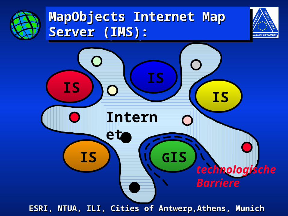
MapObjects Internet Map MapObjects Internet Map Server (IMS):Server (IMS):MapObjects Internet Map MapObjects Internet Map Server (IMS):Server (IMS):
IS
GIS
IS
IS
ISInternet
technologischeBarriere

ESRI, NTUA, ILI, Cities of Antwerp,Athens, MunichESRI, NTUA, ILI, Cities of Antwerp,Athens, Munich
9
Environment Infrastructure
Traffic
Parcel data
Population
Budget
SocialData
AttributesAttributesID
123
ID
123
ID
123
Locational dataLocational dataGISGISGISGIS
Integration by Integration by GIS !GIS !

ESRI, NTUA, ILI, Cities of Antwerp,Athens, MunichESRI, NTUA, ILI, Cities of Antwerp,Athens, Munich
MapObjects Internet MapObjects Internet Map Server (IMS):Map Server (IMS):MapObjects Internet MapObjects Internet Map Server (IMS):Map Server (IMS):
SQL-NavigationVRML-Navigation
GIS-Navigation

ESRI, NTUA, ILI, Cities of Antwerp,Athens, MunichESRI, NTUA, ILI, Cities of Antwerp,Athens, Munich
Work packagesWork packages
USER RequirementsUSER RequirementsSystem ArchitectureSystem ArchitectureTechnology developmentTechnology developmentDemonstrations, Demonstrations,
ValidationsValidations
ESRI, NTUA, ILI, Cities of Antwerp,Athens, MunichESRI, NTUA, ILI, Cities of Antwerp,Athens, Munich
User RequirementsUser Requirements
USER Requirements are basedUSER Requirements are based methodological informationmethodological information interviewsinterviews review of the literaturereview of the literature feedback from similar EU projectsfeedback from similar EU projects interviews with municipalitiesinterviews with municipalities interaction with other telematics projectsinteraction with other telematics projects contacts with GIS & s/w producerscontacts with GIS & s/w producers contacts with credits agencies (VISA)contacts with credits agencies (VISA) additional sourcesadditional sources

ESRI, NTUA, ILI, Cities of Antwerp,Athens, MunichESRI, NTUA, ILI, Cities of Antwerp,Athens, Munich
User NeedsUser Needs
Sophisticated UsersAdministrationSchoolsUniversities
Public UsersOfficial BuildingsStreets, HomesMedia-Interaction
Publicf.e. Public Traffic Users
Semi-High-End-Info on DemandSimple evaluation models with
integrated GIS SolutionsAggregated Data
Semi-aggregated Data
Information on DemandPublic Access Terminals
Internet/TouchscreenEnvironment Maps as Pictures
Summarized Data
High-End Information on DemandEnvironmental Evaluation Models
with professional GIS-SolutionsStatistical Analysis; Non-aggregated,
Semiaggregated and Aggregated Data
Take it or leave it InfoPublic Information Panels
BroadcastingSimplified Data
One DatabaseOne Database
Static DataStatic Data
High End UsersResearchSpecialists in AdministrationPlannersOffices/European Agencies
DynamicDynamicDataData

ESRI, NTUA, ILI, Cities of Antwerp,Athens, MunichESRI, NTUA, ILI, Cities of Antwerp,Athens, Munich
System ArchitectureSystem Architecture

ESRI, NTUA, ILI, Cities of Antwerp,Athens, MunichESRI, NTUA, ILI, Cities of Antwerp,Athens, Munich
Multi tieredMulti tieredClient Server ArchitectureClient Server Architecture
SDESDE
GeometrieGeometrie
RDBMSRDBMSHTMLHTMLdynamischdynamisch
HTMLHTMLstatischstatischHTMLHTMLdynamischdynamischASP/ASP/DHTMLDHTMLScriptsScripts
.AEP.AEP
J ava-J ava-ScriptScript
.AEPAEP
http tcptcp
VB-VB-ScriptScriptActiveXActiveXOLE-DBOLE-DBADOADO
ODBC
HTTPDHTTPD
APIAPI
ControlControlApplAppl
tcp
DLLDLLApplApplServerServer

ESRI, NTUA, ILI, Cities of Antwerp,Athens, MunichESRI, NTUA, ILI, Cities of Antwerp,Athens, Munich
Loading ToolsLoading Tools
-Browsers-Browsers
-Parameters-Parameters
-Data Conversion, -Data Conversion, ImportImport
Toolkit FunctionsToolkit Functions
Data Navigation ToolsData Navigation Tools
-Browsers-Browsers
-Application Server-Application Server
Data ProcessingData Processing ToolsTools
-Buffering, Intersect-Buffering, Intersect
-Arc View-Arc View

ESRI, NTUA, ILI, Cities of Antwerp,Athens, MunichESRI, NTUA, ILI, Cities of Antwerp,Athens, Munich
InfrastructureInfrastructure
-TCP-IP Network, DNS Services, Routing -TCP-IP Network, DNS Services, Routing services, firewall (Internet), Security services, services, firewall (Internet), Security services, billing services hardwarebilling services hardware
Software ComponentsSoftware Components
WebserverWebserver-HTML sources, Java applets classes-HTML sources, Java applets classes
Application Server ComponentsApplication Server Components-Map Objects (MO) IMS and wrapper classes-Map Objects (MO) IMS and wrapper classes
-Application Server Scenarios (appl. Server logic, -Application Server Scenarios (appl. Server logic, appl projects, appl objects) Geodata sources, appl projects, appl objects) Geodata sources, Geodata server (SDE), MetadataGeodata server (SDE), Metadata
ClientClientHTML Browser, HTML Browser, -JAVA-Applet for status JAVA-Applet for status information and special functionsinformation and special functions

ESRI, NTUA, ILI, Cities of Antwerp,Athens, MunichESRI, NTUA, ILI, Cities of Antwerp,Athens, Munich
Tool-Kit ApplicationsTool-Kit Applications
Distribution of Environmental city information Distribution of Environmental city information (habitat quality, air quality, noise distribution, (habitat quality, air quality, noise distribution, traffic emmissions)traffic emmissions)
environmental modelling (air pollution model, environmental modelling (air pollution model, noise calculation, habitat balancing)noise calculation, habitat balancing)
disribution of environmental educational data disribution of environmental educational data (maps of different air pollutants, parks, green (maps of different air pollutants, parks, green areas, environmental reduction programs)areas, environmental reduction programs)

ESRI, NTUA, ILI, Cities of Antwerp,Athens, MunichESRI, NTUA, ILI, Cities of Antwerp,Athens, Munich
Tool-Kit ToolsTool-Kit Tools Pan-Zoom through multiple map layersPan-Zoom through multiple map layers display data using classifications, graduated symbolsdisplay data using classifications, graduated symbols ESRI shape files, ARC/INFO coverages, SDE layersESRI shape files, ARC/INFO coverages, SDE layers variety of image formatsvariety of image formats perform spatial analysis and queryperform spatial analysis and query perform on-line network navigationperform on-line network navigation use relational DB and SQL queriesuse relational DB and SQL queries perform address matching & geocodingperform address matching & geocoding track real time events with GPStrack real time events with GPS pay via the Internetpay via the Internet open system in terms of dataopen system in terms of data

ESRI, NTUA, ILI, Cities of Antwerp,Athens, MunichESRI, NTUA, ILI, Cities of Antwerp,Athens, Munich
Munich - the city Munich - the city partnerpartnerMunich - the city Munich - the city partnerpartner
project goalsproject goals

ESRI, NTUA, ILI, Cities of Antwerp,Athens, MunichESRI, NTUA, ILI, Cities of Antwerp,Athens, Munich
Decision aid for administrationDecision aid for administration Up-to-date information for the Up-to-date information for the
publicpublic Dissemination of basic Dissemination of basic
informationinformation In-depth-Information for In-depth-Information for
specialistsspecialists Strengthening Strengthening
"environment and health "environment and health awareness"awareness"
Environment InformationEnvironment Information
Global AimsGlobal AimsEnvironment InformationEnvironment Information
Global AimsGlobal Aims

ESRI, NTUA, ILI, Cities of Antwerp,Athens, MunichESRI, NTUA, ILI, Cities of Antwerp,Athens, Munich
Project goals - Project goals - mapservermapserverProject goals - Project goals - mapservermapserver
Platform and OS indepencePlatform and OS indepence "best viewed with any browser""best viewed with any browser" Real-time internationalization Real-time internationalization modular application designmodular application design Embedded Documentation (xml), perlEmbedded Documentation (xml), perl Standard ArcView for Map PrototypingStandard ArcView for Map Prototyping

ESRI, NTUA, ILI, Cities of Antwerp,Athens, MunichESRI, NTUA, ILI, Cities of Antwerp,Athens, Munich
Project goals - Project goals - cdrom datacdrom dataProject goals - Project goals - cdrom datacdrom data
geographical data encryptiongeographical data encryptionviewers on WinNT platformviewers on WinNT platformseamless integration of online seamless integration of online
internet datainternet data

ESRI, NTUA, ILI, Cities of Antwerp,Athens, MunichESRI, NTUA, ILI, Cities of Antwerp,Athens, Munich
Project goals Project goals Licensing/interfaceLicensing/interfaceProject goals Project goals Licensing/interfaceLicensing/interface
Open SourceOpen SourceGNU Copyleft orGNU Copyleft orPerl Artistic LicensePerl Artistic License
for MAPSERVERfor MAPSERVERopen, standardized XML-Interfaceopen, standardized XML-Interface

ESRI, NTUA, ILI, Cities of Antwerp,Athens, MunichESRI, NTUA, ILI, Cities of Antwerp,Athens, Munich
SoftwareSoftwareSoftwareSoftware
ArcInfo 7.2.1 ArcInfo 7.2.1 ArcView 3.01ArcView 3.01MapObjects 1.2MapObjects 1.2MoIMS 1.0MoIMS 1.0Apache/M$-IIS WebserverApache/M$-IIS WebserverOracle 7/Access-ODBC databaseOracle 7/Access-ODBC databaseSGML w. emacs/perl forSGML w. emacs/perl for documentsdocuments

ESRI, NTUA, ILI, Cities of Antwerp,Athens, MunichESRI, NTUA, ILI, Cities of Antwerp,Athens, Munich
ApplicationsApplicationsApplicationsApplications
ArcInfo sectoral GIS information ArcInfo sectoral GIS information system of the citysystem of the city
ArcView prototyping for ArcView prototyping for mapservermapserver
mapserver reading odbsmapserver reading odbsCGI/database address-matchingCGI/database address-matchingSGML document handling systemSGML document handling system

ESRI, NTUA, ILI, Cities of Antwerp,Athens, MunichESRI, NTUA, ILI, Cities of Antwerp,Athens, Munich
DemonstrationsDemonstrationsValidationsValidations
TelepolisTelepolis
City of AntwerpCity of AntwerpNavigational map for routingNavigational map for routing
Implementation of EnvironmentalImplementation of Environmental
Information for route selectionInformation for route selection
User interface for Info KiosksUser interface for Info Kiosks

ESRI, NTUA, ILI, Cities of Antwerp,Athens, MunichESRI, NTUA, ILI, Cities of Antwerp,Athens, Munich

ESRI, NTUA, ILI, Cities of Antwerp,Athens, MunichESRI, NTUA, ILI, Cities of Antwerp,Athens, Munich

ESRI, NTUA, ILI, Cities of Antwerp,Athens, MunichESRI, NTUA, ILI, Cities of Antwerp,Athens, Munich

ESRI, NTUA, ILI, Cities of Antwerp,Athens, MunichESRI, NTUA, ILI, Cities of Antwerp,Athens, Munich

ESRI, NTUA, ILI, Cities of Antwerp,Athens, MunichESRI, NTUA, ILI, Cities of Antwerp,Athens, Munich
DemonstrationsDemonstrationsValidationsValidations
City ofCity of
AthensAthensRemote Internet accessRemote Internet access
Navigational city databaseNavigational city database
Online Air Quality Reporting andOnline Air Quality Reporting and
healthy routing proposalshealthy routing proposals

ESRI, NTUA, ILI, Cities of Antwerp,Athens, MunichESRI, NTUA, ILI, Cities of Antwerp,Athens, Munich
City of AthensCity of Athens

ESRI, NTUA, ILI, Cities of Antwerp,Athens, MunichESRI, NTUA, ILI, Cities of Antwerp,Athens, Munich
DemonstrationsDemonstrationsValidationsValidations
City of MunichCity of MunichEmissions, ImmissionsEmissions, Immissions
Environmental maps on demandEnvironmental maps on demand
Healthy and educational Bycicle RoutingHealthy and educational Bycicle Routing

ESRI, NTUA, ILI, Cities of Antwerp,Athens, MunichESRI, NTUA, ILI, Cities of Antwerp,Athens, Munich

ESRI, NTUA, ILI, Cities of Antwerp,Athens, MunichESRI, NTUA, ILI, Cities of Antwerp,Athens, Munich
Project statusProject statusProject statusProject status Environmental GIS in daily useEnvironmental GIS in daily useMapserver prototyping Mapserver prototyping Mapserver up and runningMapserver up and runningSGML document environment in daily SGML document environment in daily
useuseCadasdral map of munich in workCadasdral map of munich in workNavigational Bicycle map of Munich in Navigational Bicycle map of Munich in
workwork

ESRI, NTUA, ILI, Cities of Antwerp,Athens, MunichESRI, NTUA, ILI, Cities of Antwerp,Athens, Munich
The CityThe CityInnovationInnovation::
on-line use of navigational GISon-line use of navigational GISon-line billing and security systemon-line billing and security systempackaging of a generic tool-kitpackaging of a generic tool-kitportability to evolving needs & interoperability of the portability to evolving needs & interoperability of the
tool-kittool-kitefficient operation on the Internetefficient operation on the Internetmetadata featuresmetadata features

ESRI, NTUA, ILI, Cities of Antwerp,Athens, MunichESRI, NTUA, ILI, Cities of Antwerp,Athens, Munich
The CityThe CityBenefitsBenefits::
world citizens have a demand for world citizens have a demand for gratis , gratis , on-line and navigationalon-line and navigational information to information to be obtained by standard Internet be obtained by standard Internet browsersbrowsers
Citizens use systems only when they can Citizens use systems only when they can access and get at no costaccess and get at no cost

ESRI, NTUA, ILI, Cities of Antwerp,Athens, MunichESRI, NTUA, ILI, Cities of Antwerp,Athens, Munich
For Your AttentionFor Your Attention
Thank Thank YouYou