presentazione qgis
TRANSCRIPT

M.Bancheri & L.Perathoner
QGIS Un Sistema di Informazione Geografica Libero e Open Source
http://www2.qgis.org/it/site/

Barra dei menu
Barra degli strumenti
Legenda
Barra di stato
Vista mappa
Interfaccia grafica di QGIS http://docs.qgis.org/2.6/it/docs/user_manual/

Manuale utente di QGIS http://docs.qgis.org/2.6/it/docs/user_manual/

Come importare un rasterhttp://docs.qgis.org/2.6/it/docs/user_manual/working_with_raster/index.html
Aggiungi raster
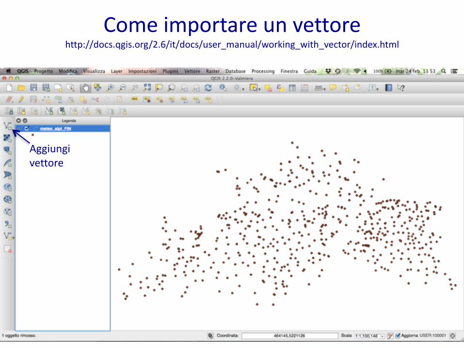
Come importare un vettore http://docs.qgis.org/2.6/it/docs/user_manual/working_with_vector/index.html
Aggiungi vettore

Strumento informazioni: rasterhttp://docs.qgis.org/2.6/it/docs/user_manual/introduction/general_tools.html
Informazioni elementi
Click sul punto

Strumento informazioni: vettorehttp://docs.qgis.org/2.6/it/docs/user_manual/introduction/general_tools.html
Informazioni elementi
Click sull’elemento

Proprietà layer: rasterhttp://docs.qgis.org/2.6/it/docs/user_manual/working_with_raster/raster_properties.html
Tasto destro-‐Proprietà

Proprietà layer: vettorehttp://docs.qgis.org/2.6/it/docs/user_manual/working_with_vector/vector_properties.html
Tasto destro-‐Proprietà

Plugin GRASS: crere l'ambiente location/mapsethttp://docs.qgis.org/2.6/it/docs/user_manual/grass_integration/grass_integration.html
Nuovo mapset