tgs gps-geonews
TRANSCRIPT
See the energy at TGS.com
© 2016 TGS-NOPEC Geophysical Company ASA. All rights reserved.
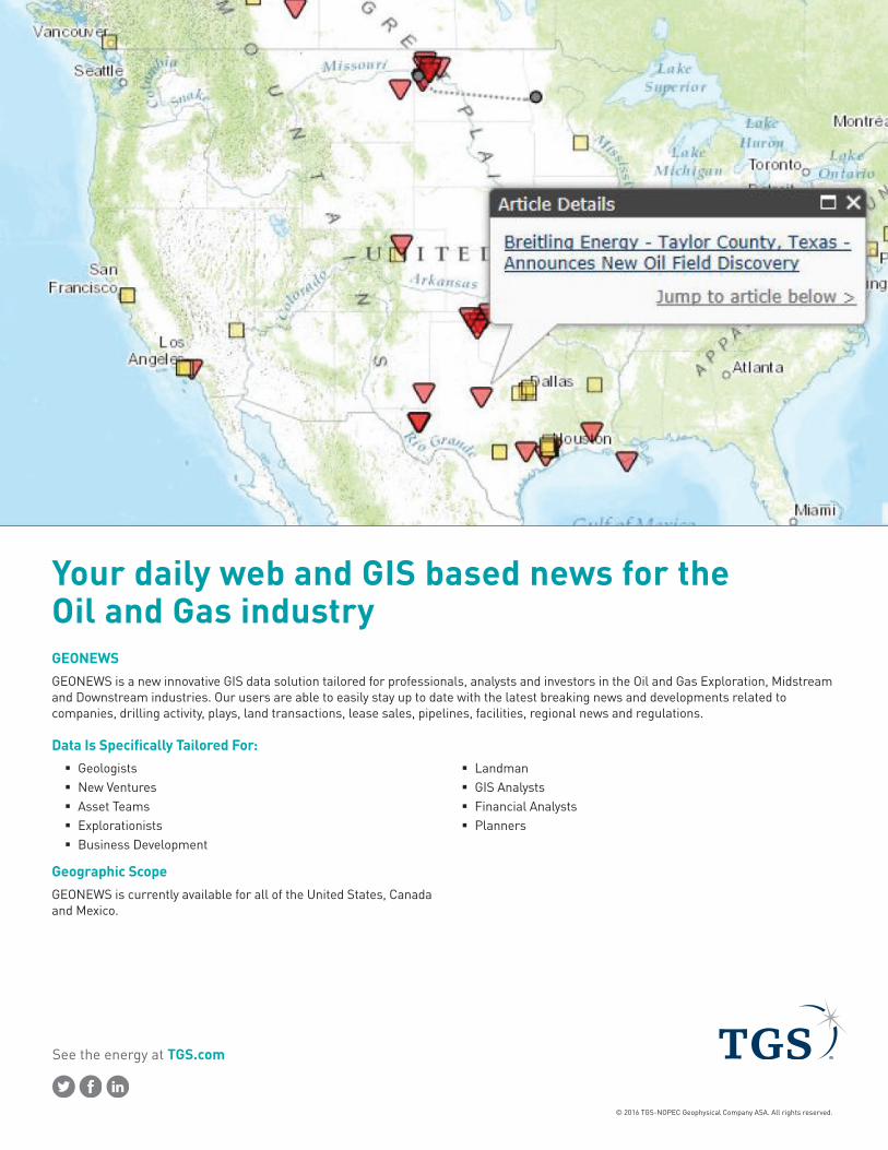
Your daily web and GIS based news for the Oil and Gas industryGEONEWSGEONEWS is a new innovative GIS data solution tailored for professionals, analysts and investors in the Oil and Gas Exploration, Midstream and Downstream industries. Our users are able to easily stay up to date with the latest breaking news and developments related to companies, drilling activity, plays, land transactions, lease sales, pipelines, facilities, regional news and regulations.
Data Is Specifically Tailored For: � Geologists � New Ventures � Asset Teams � Explorationists � Business Development
� Landman � GIS Analysts � Financial Analysts � Planners
Geographic ScopeGEONEWS is currently available for all of the United States, Canada and Mexico.

See the energy at TGS.com
© 2016 TGS-NOPEC Geophysical Company ASA. All rights reserved.
Data Highlights: � Data Groups – total of 5 are included; Categories, Companies,
USGS Provinces, Plays and Formations.
� Data Tagging – includes Company, Categories (40), USGS Provinces, Plays, Formations, Fields,Countries, States/Provinces, Counties, Cities, Offshore Blocks, Longitude/Latitude, Land A&D, Lease, Well Header, Well Details, Well Production, Prospects, Midstream A&D, Midstream Facility, Rail, Pipeline, and Barge/Tanker.
� Data Attributes – the database has been designed for in-depth data analysis purposes and includes more than 250 data attributes.
� Data Interfacing – data is available via Web, Mobile, Email and Desktop Applications.
� External Linkage – hyperlinks are provided to the source data for further analysis.
Data Availability and PricingSubscribers have access to all US and Canadian coverage. Data can be licensed for both the Web Based Application and the Esri Map Services. The Web Based Application is available on a per user/seat basis. The Esri Map Service is available on a corporate wide basis. Standard subscription terms are for one year.
US Tel: +1 713 860 2100Email: [email protected]
For more information, contact TGS at: