university of tsukuba - 筑波大学giswin.geo.tsukuba.ac.jp/sis/gis_seminar/20121220aghasi.pdf ·...
TRANSCRIPT
Introduction of mapwindow
University of Tsukuba
Lifr and enviromental Sciences
Division of Spatial Information Sciences
Niloofar Haji Mirza Aghasi
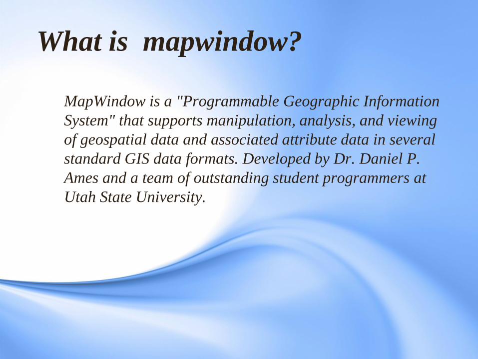
MapWindow is a "Programmable Geographic Information
System" that supports manipulation, analysis, and viewing
of geospatial data and associated attribute data in several
standard GIS data formats. Developed by Dr. Daniel P.
Ames and a team of outstanding student programmers at
Utah State University.
What is mapwindow?
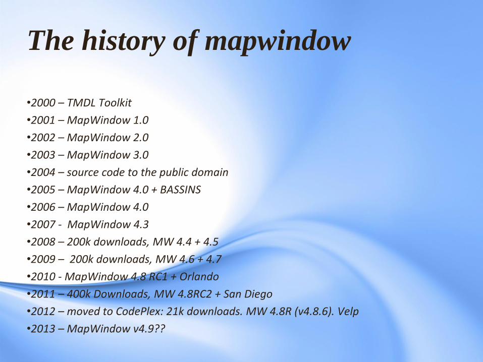
The history of mapwindow
•2000 – TMDL Toolkit
•2001 – MapWindow 1.0
•2002 – MapWindow 2.0
•2003 – MapWindow 3.0
•2004 – source code to the public domain
•2005 – MapWindow 4.0 + BASSINS
•2006 – MapWindow 4.0
•2007 - MapWindow 4.3
•2008 – 200k downloads, MW 4.4 + 4.5
•2009 – 200k downloads, MW 4.6 + 4.7
•2010 - MapWindow 4.8 RC1 + Orlando
•2011 – 400k Downloads, MW 4.8RC2 + San Diego
•2012 – moved to CodePlex: 21k downloads. MW 4.8R (v4.8.6). Velp
•2013 – MapWindow v4.9??
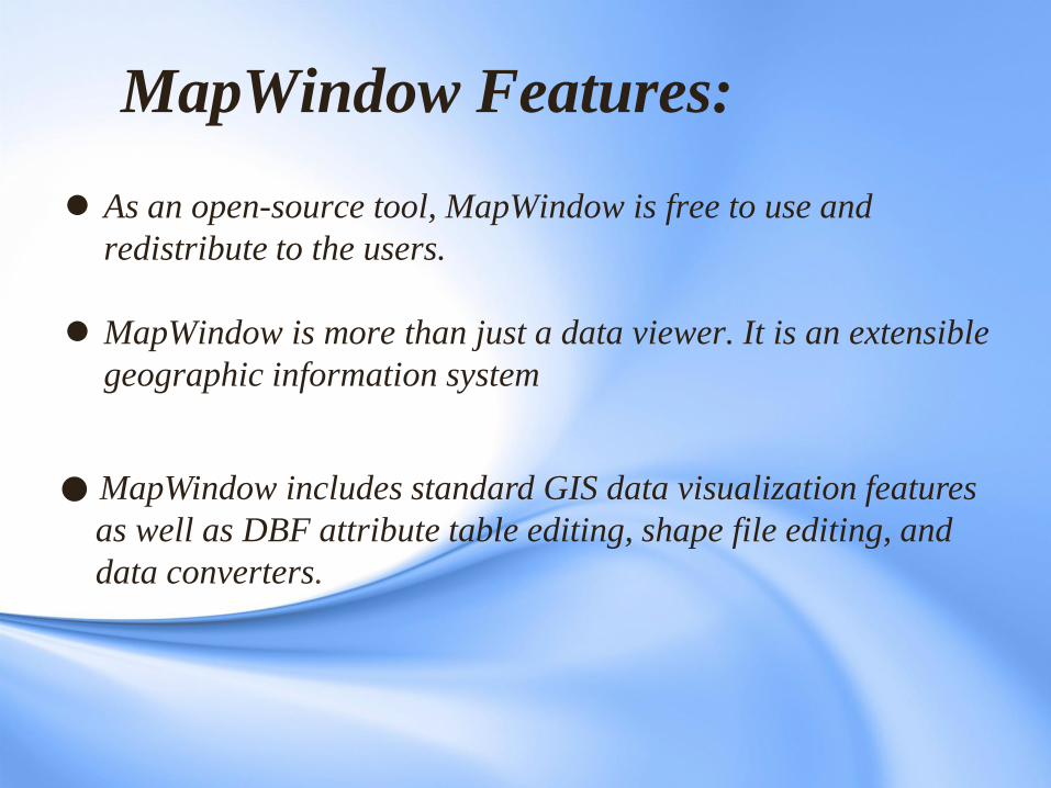
As an open-source tool, MapWindow is free to use and
redistribute to the users.
MapWindow is more than just a data viewer. It is an extensible
geographic information system
MapWindow Features:
MapWindow includes standard GIS data visualization features
as well as DBF attribute table editing, shape file editing, and
data converters.
MapWindow Features:
MapWindow also includes a complete
ActiveX component which may be used to
instantly add GIS capabilities to the
user’s existing software product.
MapWindow Overview
MapWindow was written to satisfy a need for a
robust and powerful GIS programming tool that
be used for GIS software applications.
MapWindow consists of the
• main MapWindow application
• Core Components
. Mapwindow GIS
.Mapwindow Interfaces
. MapWindow Geo proccessing
• plug-ins

MapWindow consists of the main
MapWindow application, Core Components,
and plug-ins:
• Main MapWindow Application
This is the central interface for MapWindow. From here, you
may view data elements such as Shape files and Grids.
• Core Components • MapWindow GIS
this is the main map component if you want to write a program
that displayed shape data.
• MapWindow Interfaces
Also called the plugs-in Interface
• MapWindow Geo processing
set of tools for common geo processing
Mapwindow Geo processing
• MapWindow includes a set of tools for common geo processing
tasks. The main suite of tools is found in the GIS ‘Toolbox’,
which is a tab under the legend. A few others exist as
independent plug-ins .
• Buffer shapes
• Vector overlays, including intersection and union
• Various clipping operations, including clip using shapefile or
polygon mask
• Dissolve shapes by attribute
• Calculate polygon areas
• Various projection functions
• Several raster operations, including clip by polygon, merge
grids, and reclassify
•Plug-ins
These are specialized tools written to interact with the main
MapWindow application. Where MapWindow is mainly a data
viewing tool, the real power of MapWindow comes in the form
of plug-ins.
The MapWindow installer includes plug-ins for hyperlinking
from geographic features, editing attribute tables, editing
shape files, labeling shape files, identifying features and cells,
and performing some geo processing.
Other plug-ins are available via the MapWindow website and
are under development by the MapWindow team as well as
by third parties for various custom applications.
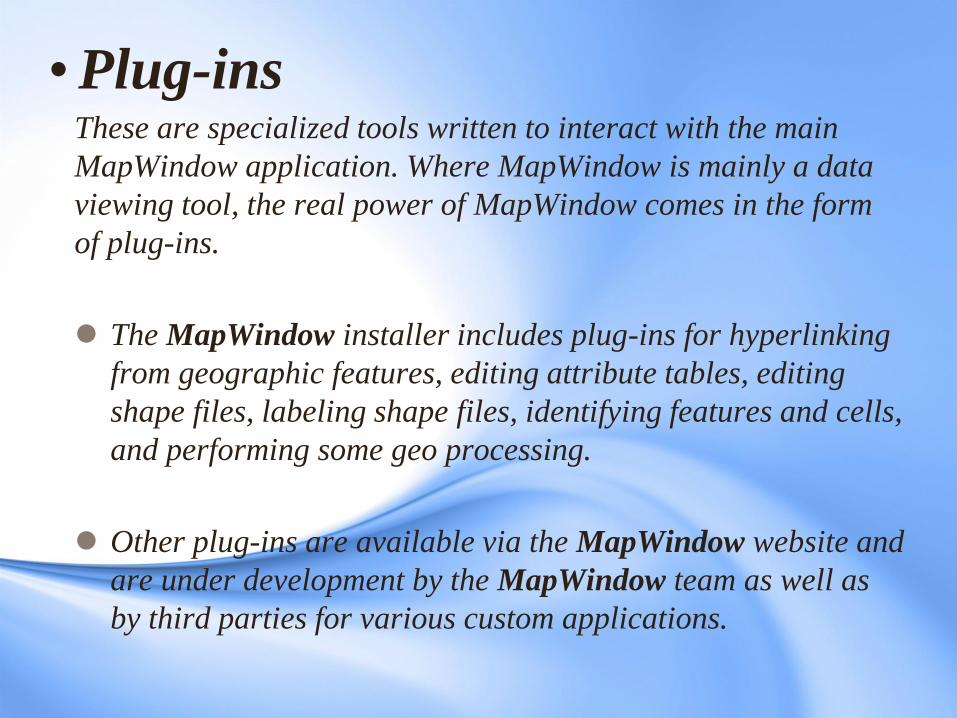
Four main plug-ins come with the main MapWindow application;
these are the Table Editor, Shape file Editor, Grid Wizard, and
Feature Identifier/Labeler.
picture of the main MapWindow screen with the Plug-in Menu open
MapWindow
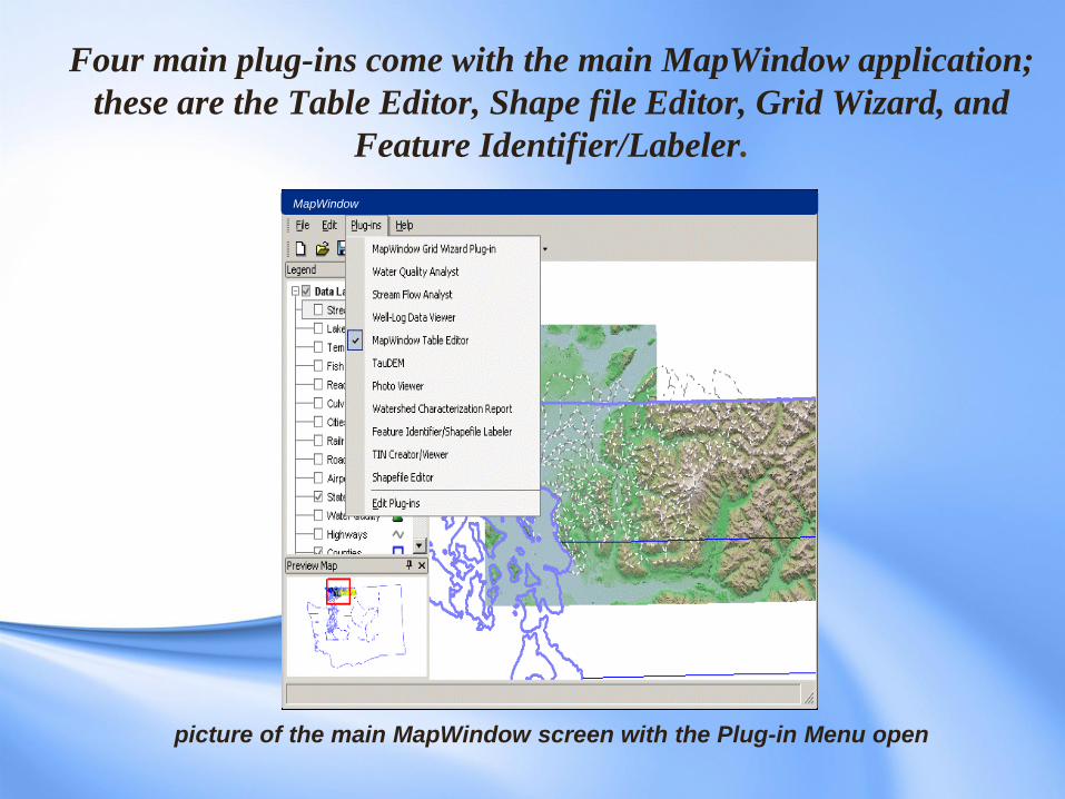
To turn a plug-in on or
off, first display the
Plug-in list by clicking
on the menu item
labeled Plug-ins.
Click the desired plug-
in to turn it on or off. If
there is a check next to
the plug-in in the list, it
means the plug-in is
turned on and enabled;
if there is no check, it is
not currently turned on.
MapWindow
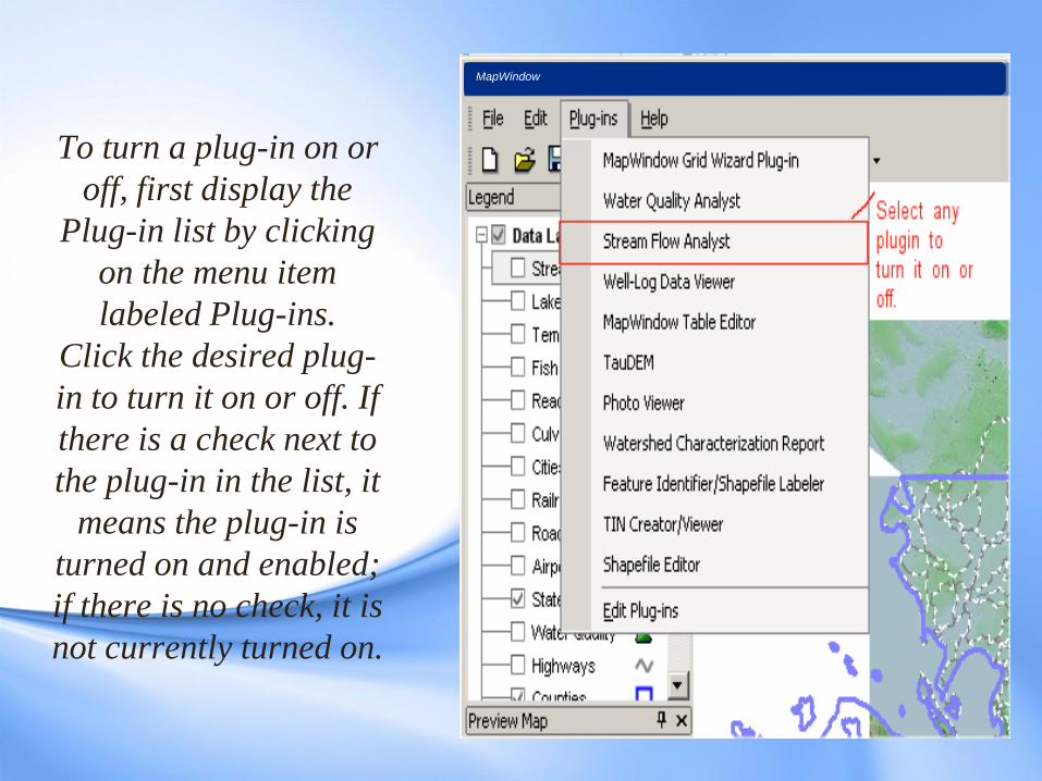
How to View Details About a Plug-in
To view the details about a plug-in such as the author name or a
description, first select the Plug-ins menu, then select "Edit Plug-
ins", as shown below.
MapWindow
Adding Custom Functionality to
MapWindow by Writing Plug-Ins
MapWindow is based on an extensible software that
allows developers or users to produce plug-ins that add
functionality to the core product. Several plug-ins are
under development at USU that provide graphical user
interfaces for shape file and attribute table editing and
querying, as well as plug-ins with specific hydrologic
and environmental modelling applications such as
watershed delineation.
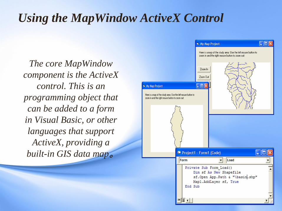
Using the MapWindow ActiveX Control
The core MapWindow
component is the ActiveX
control. This is an
programming object that
can be added to a form
in Visual Basic, or other
languages that support
ActiveX, providing a
built-in GIS data map。
Additional functions of the core component
ActiveX control include:
• Open, create, edit, and save geo-referenced image, grid, shapefile,
triangulated irregular network (TIN), and dbf (shape attribute) data directly;
• View, label, color, highlight, shape file data in the map;
• Perform spatial queries on the data;
• Search for features with specific attributes;
• Dynamically edit the spatial data and immediately see the changes in the
map;
• Interact with the data through the map;
• Build TINs from Grids, Images from Grids, Shape files from TINs and Grids,
Grids from Shape files, etc.
• Much, much, more...
MapWindow License Information
The MapWindow Application is free to use as a GIS
data visualization and analysis tool. You are free to
redistribute MapWindow with your GIS data for others
to view it according to the MapWindow application
license agreement. Additionally, the MapWindow
default plug-ins are free to use and redistribute as
needed. Other plug-in use and redistribution licenses
are determined by plug-in authors and may differ.
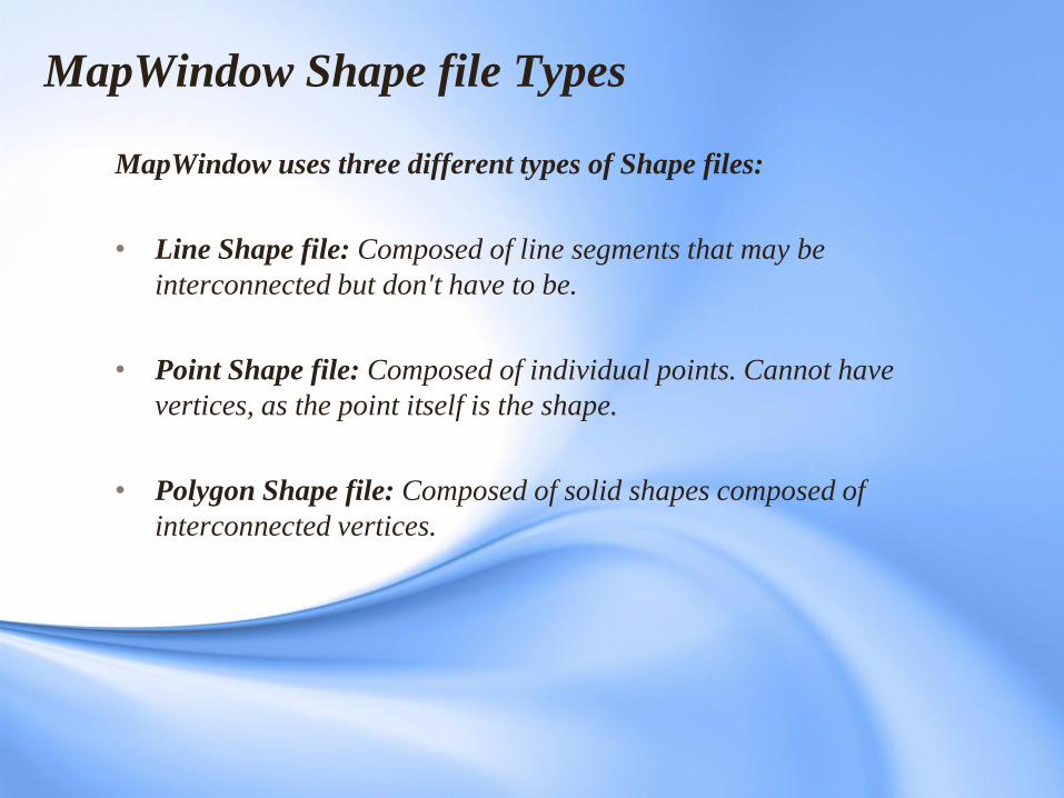
MapWindow Shape file Types
MapWindow uses three different types of Shape files:
• Line Shape file: Composed of line segments that may be
interconnected but don't have to be.
• Point Shape file: Composed of individual points. Cannot have
vertices, as the point itself is the shape.
• Polygon Shape file: Composed of solid shapes composed of
interconnected vertices.
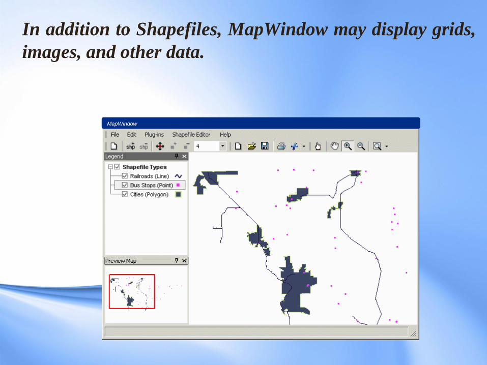
In addition to Shapefiles, MapWindow may display grids,
images, and other data.
MapWindow
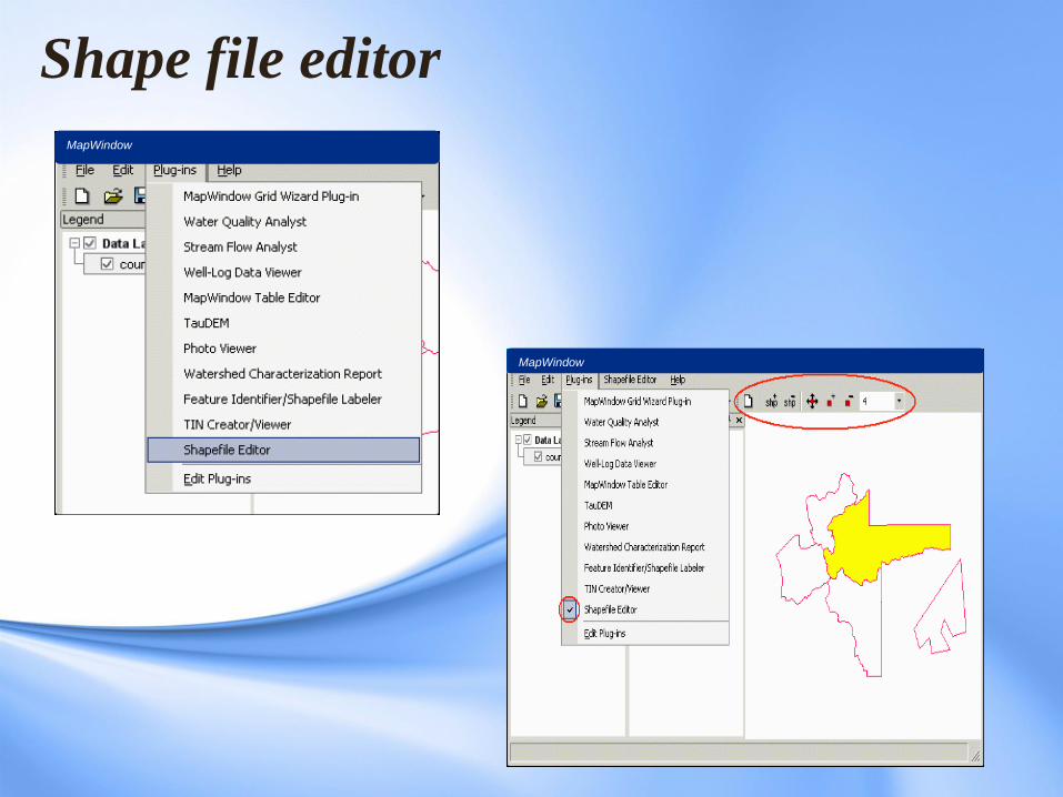
Shape file editor
MapWinow MapWindow
MapWindow
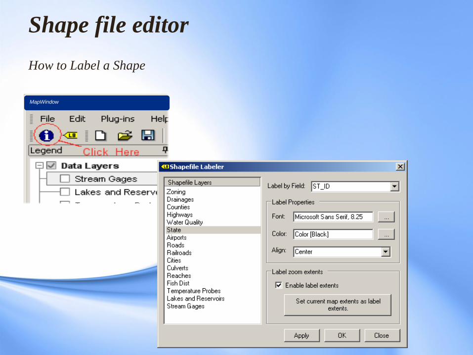
Shape file editor How to Label a Shape
MapWindow
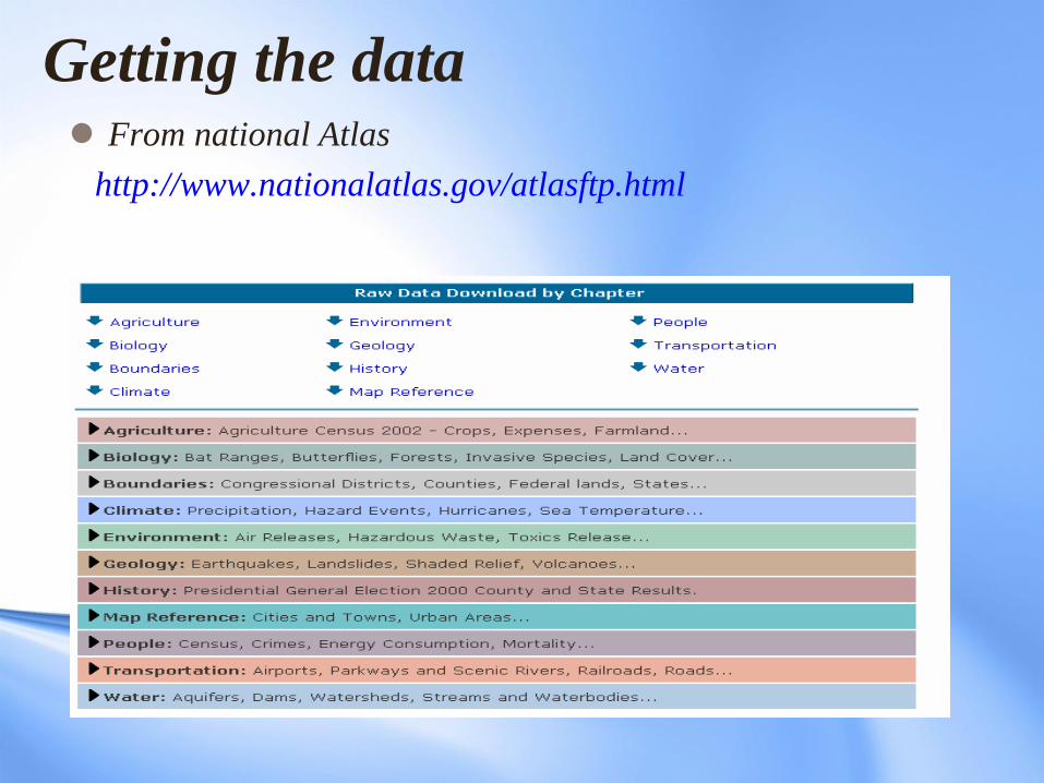
Getting the data From national Atlas
http://www.nationalatlas.gov/atlasftp.html
Getting the Software
The MapWindow GIS software is freely available to
download from the MapWindow website www.mapwindow.org.
In addition, there are further Plug Ins to add capability to
the base software for download from the site.
References
Adapted from Introduction to MapWindow Tutorial Version 4.3 –
Original Document Authors, Gary Watry, Daniel P. Ames,
Ph.D,Christopher Michaelis
Introduction to Custom GIS Application, Development for Windows,
Brian Marchionni,Idaho State University, geo Spatial Software Lab.