welcome 2 malaysia - international federation of...
TRANSCRIPT
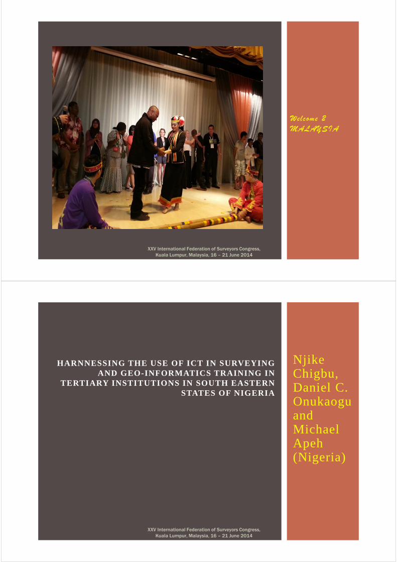
Welcome 2
MALAYSIA
XXV International Federation of Surveyors Congress,
Kuala Lumpur, Malaysia, 16 – 21 June 2014
Njike Chigbu, Daniel C. Onukaogu and Michael Apeh (Nigeria)
HARNNESSING THE USE OF ICT IN SURVEYING AND GEO-INFORMATICS TRAINING IN
TERTIARY INSTITUTIONS IN SOUTH EASTERN STATES OF NIGERIA
XXV International Federation of Surveyors Congress,
Kuala Lumpur, Malaysia, 16 – 21 June 2014
PRESENTATION OUTLINE
XXV International Federation of Surveyors Congress,
Kuala Lumpur, Malaysia, 16 – 21 June 2014
� INTRODUCTION
� BASIC DEFINITIONS OF CONCEPTS
� ICTs IN DEVELOPMENT
� ICT EDUCATION AND ICT EDUCATION AND ICT EDUCATION AND ICT EDUCATION AND IMPORTANCEIMPORTANCEIMPORTANCEIMPORTANCE
� BENEFITS OF ICT IN SURVEYING AND GEOINFORMATICS TRAINING
� APPLICATION AREAS IN SURVEYING AND GEOINFORMATICS
� AIM & OBJECTIVES OF THIS WORK
� METHODOLOGY� A STUDY OF THE SELECTED INSTITUTIONS� APPRAISAL
XXV International Federation of Surveyors Congress,
Kuala Lumpur, Malaysia, 16 – 21 June 2014
� RECOMMENDATION AND CONCLUSION� REFERENCES� BIBLIOGRAPHICAL NOTES� ACKNOWLEDGEMENT
INTRODUCTION CONTD
XXV International Federation of Surveyors Congress,
Kuala Lumpur, Malaysia, 16 – 21 June 2014
� The world is moving at an unimaginable speed in the area of
information use and dissemination.
� The most vibrant sector of the national economy is the
information technology industry as well as the educational
sector (UNESCO, 2002).
� Generally, ICT holds out the opportunity to revolutionize
teaching methods, expand access to quality education and
improve the management of education system (World Bank,
2002).
INTRODUCTION
XXV International Federation of Surveyors Congress,
Kuala Lumpur, Malaysia, 16 – 21 June 2014
� ICT represents an embedded platform which comprises of
facilities or technologies aimed at information processing and
electronic communication (Ndukwe 2008).
� In real terms, ICT supports any type of training either through
the teaching or learning medium due to its ease of use,
dynamic, interactive, flexible and engaging model. It sheds
more light in terms of real opportunity to and individualized
institution.
INTRODUCTION CONTD.
XXV International Federation of Surveyors Congress,
Kuala Lumpur, Malaysia, 16 – 21 June 2014
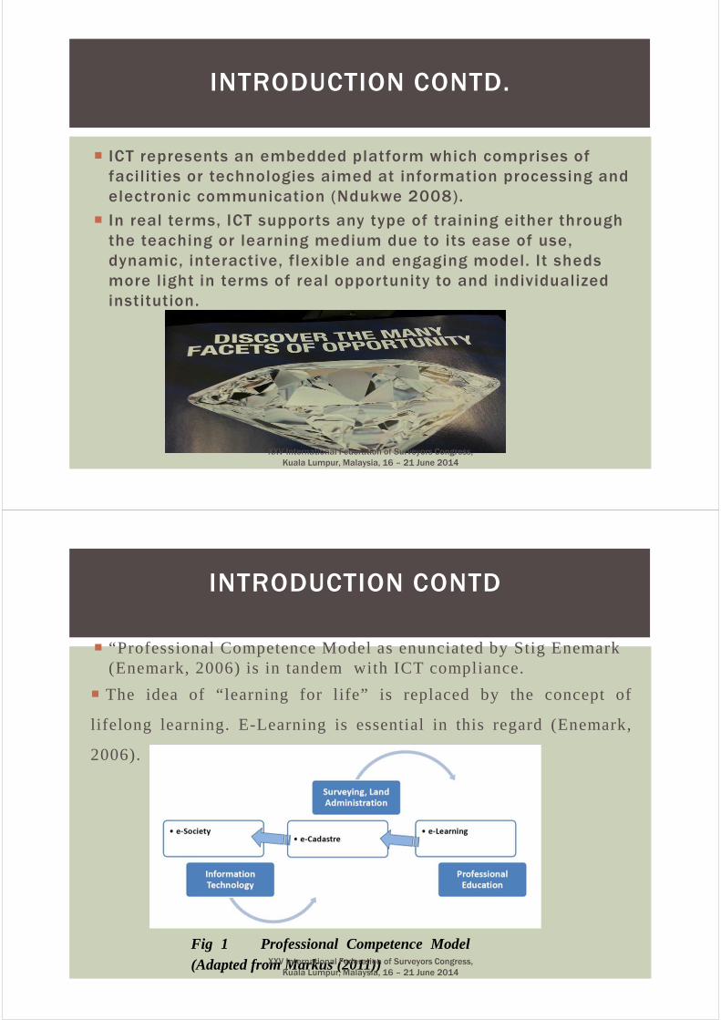
� “Professional Competence Model as enunciated by Stig Enemark (Enemark, 2006) is in tandem with ICT compliance.
� The idea of “learning for life” is replaced by the concept of
lifelong learning. E-Learning is essential in this regard (Enemark,
2006).
INTRODUCTION CONTD
Fig 1 Professional Competence Model(Adapted from Markus (2011))XXV International Federation of Surveyors Congress,
Kuala Lumpur, Malaysia, 16 – 21 June 2014

� Geoinformatics can be defined as a body of knowledge that deals with theacquisition, processing, manipulation, presentation and dissemination ofspatial data using information technology.
� It combines geospatial analysis and modeling, development ofgeospatial databases, information systems design, human-computer interaction and both wired and wireless networkingtechnologies.
� It uses geocomputation and geovisualization for analyzinggeoinformation
WHAT IS GEOINFORMATICS ?WHAT IS GEOINFORMATICS ?WHAT IS GEOINFORMATICS ?WHAT IS GEOINFORMATICS ?
Fig 2 Geoinformatics & Internet computing domain source: UNEC, 2013.XXV International Federation of Surveyors Congress,
Kuala Lumpur, Malaysia, 16 – 21 June 2014
AREAS OF APPLICATION OF ICT IN SURVEYING & GEOINFORMATICS
CartographyCartographyCartographyCartography GeodesyGeodesyGeodesyGeodesyGIS
GNSSRemote
Sensing
Web Mapping
Photogrammetry
XXV International Federation of Surveyors Congress,
Kuala Lumpur, Malaysia, 16 – 21 June 2014
�Training for general ICT skills involve training in computer appreciation, office application Programmes, sending email, use of internet to mention but a few.
�While training for specific ICT skills involves howto use computers in subject based teaching,computer assisted instruction (CAI) packages andso on
DEFINITION CONTD.
XXV International Federation of Surveyors Congress,
Kuala Lumpur, Malaysia, 16 – 21 June 2014
� Urban Urban Urban Urban planning and land use managementplanning and land use managementplanning and land use managementplanning and land use management
� Environmental modeling and analysisEnvironmental modeling and analysisEnvironmental modeling and analysisEnvironmental modeling and analysis
� Transport network planning and managementTransport network planning and managementTransport network planning and managementTransport network planning and management
� Agriculture, meteorology and cl imate changeAgriculture, meteorology and cl imate changeAgriculture, meteorology and cl imate changeAgriculture, meteorology and cl imate change
� Oceanography and coupled ocean and atmosphere modelingOceanography and coupled ocean and atmosphere modelingOceanography and coupled ocean and atmosphere modelingOceanography and coupled ocean and atmosphere modeling
� Architecture and archeological reconstructionArchitecture and archeological reconstructionArchitecture and archeological reconstructionArchitecture and archeological reconstruction
� InInInIn ----car navigation systemscar navigation systemscar navigation systemscar navigation systems
AREAS OF APPLICATION OF
GEOINFORMATICS
SOURCE: UNEC 2013.XXV International Federation of Surveyors Congress,
Kuala Lumpur, Malaysia, 16 – 21 June 2014
�Ubiquitous Computing NetworkUbiquitous Computing NetworkUbiquitous Computing NetworkUbiquitous Computing Network: Computers and Sensors,
which exit everywhere and are communicating with each other
and support our life
�Broad Broad Broad Broad bandwidthbandwidthbandwidthbandwidth
�A A A A gateway to the global technology gateway to the global technology gateway to the global technology gateway to the global technology vil lagevillagevillagevillage
�Access to Geoservices: Geodata, geoprocessing tool, open Access to Geoservices: Geodata, geoprocessing tool, open Access to Geoservices: Geodata, geoprocessing tool, open Access to Geoservices: Geodata, geoprocessing tool, open
source softwaresource softwaresource softwaresource software
�Geodata ServicesGeodata ServicesGeodata ServicesGeodata Services
� Geoprocessing ServicesGeoprocessing ServicesGeoprocessing ServicesGeoprocessing Services
� open source Toolsopen source Toolsopen source Toolsopen source Tools
USE TOOLS FOR ICT
XXV International Federation of Surveyors Congress,
Kuala Lumpur, Malaysia, 16 – 21 June 2014
� Some of Geoservice examples available from the GeoServNet :
� � Geospatial Display Services (GeoEye): This service permits
Viewing and simple querying of data . (GeoEye) supports most
display functions, such as zoom, pan, select, identify, layer
control, color style control, etc.
� � Geodata Access Services: This system allows the user to
download data from servers or upload data from the local
site. It also allows the users to overlay data layers coming
from dif ferent servers or local machines. This is a very useful
data access mode since in reality, data could come from
anywhere in a network
ICT TOOLS
XXV International Federation of Surveyors Congress,
Kuala Lumpur, Malaysia, 16 – 21 June 2014
� Map Annotation and Symbolization Services: In cartographic mapping, map annotation and symbolization are of particular value for many on-line service applications.
� � Terrain Analysis Services: Permit terrain data download ,analysis and
� � 3D Visualization: Provides 3 –D reconstruction and visualization functions .
� Distributed /Online collaboration inDistributed /Online collaboration inDistributed /Online collaboration inDistributed /Online collaboration in::::
�Geodata production
� Geodata Update
� Geoinformatics research
ICT TOOLS
XXV International Federation of Surveyors Congress,
Kuala Lumpur, Malaysia, 16 – 21 June 2014
� Some examples of onl ine col laboration tools for geodata production.
�Google Mapmaker
� Google 3D Warehouse
� Access to advanced spatial applications: 1Access to advanced spatial applications: 1Access to advanced spatial applications: 1Access to advanced spatial applications: 1
� Some examples :
�Google Maps
� Google Ear th
� MSN vir tual Ear th
� Multimap
�Read/write access to spatial databases interactively Read/write access to spatial databases interactively Read/write access to spatial databases interactively Read/write access to spatial databases interactively anywhere in the worldanywhere in the worldanywhere in the worldanywhere in the world . . . .
create s many create s many create s many create s many interesting opportunit ies, such as the abil ity to use interesting opportunit ies, such as the abil ity to use interesting opportunit ies, such as the abil ity to use interesting opportunit ies, such as the abil ity to use external databases of various external databases of various external databases of various external databases of various types.types.types.types.
ICT TOOLS
XXV International Federation of Surveyors Congress,
Kuala Lumpur, Malaysia, 16 – 21 June 2014
� Some examples of external Some examples of external Some examples of external Some examples of external databases.databases.databases.databases.
�Oceanographic database
� Weather database
� Property database
� Demographic database
� Road database
� Shuttle Radar Topographic Mission (SRTM
ICT TOOLS
XXV International Federation of Surveyors Congress,
Kuala Lumpur, Malaysia, 16 – 21 June 2014
�ICT in Schools� ICT is a crucial resource in education.� practical ICT skills transferable into the work place.
� Teachers upload course documents so that studentsmisses a lesson, they can download information and dothe work in their own time.
� Encourages student-driven lessons, where students takeresponsibility for their learning.
� learning tools would be available to students .� Allow schools to be linked and to share resources
through broad band internet access.
BENEFITS OF ICT BASED EDUCATION
XXV International Federation of Surveyors Congress,
Kuala Lumpur, Malaysia, 16 – 21 June 2014
�Ubogu & Egbezor (2007) described Informationand communication Technology (ICT) asadvances in technologies that provide a richglobal resource and collaborative environmentfor dissemination of ICT literacy material,interactive discussions, research information,and international exchange of ideas, which arecritical for advancing meaningful educationalinitiatives, training a high skilled labor force,and understanding issues related to economicdevelopment
ICTS IN DEVELOPMENT
XXV International Federation of Surveyors Congress,
Kuala Lumpur, Malaysia, 16 – 21 June 2014
� Policymakers emphasis that ICT in education has a multiplier
ef fect National Development by:
�Enhancing learning and providing students with new sets of
skills
�Reaching students with poor or access (in rural areas)
�Facilitating and improving the training of teachers
�Minimizing cost associated with delivery of traditional
instruction; and
�Improving the administration of schools in order to enhance the
quality and efficiency of service delivery.
BENEFITS CONTD.
XXV International Federation of Surveyors Congress,
Kuala Lumpur, Malaysia, 16 – 21 June 2014
� Ojedoku and Owolabi (2003) cited in Nwezeh (2014) opined thatteachers /lecturers in developing and emerging economies likeNigeria need to change their teaching styles and acquire internetskills and hence ICT skill should transform the class room in thenext two decades.
� Relevance of university education in National development can be seen in the following areas:-
�Enhancing societal development by training meaningfulyouths(citadel of learning)
�Restoration of the dignity of man(UNN motto and missionstatement)
�Enhancing and improving the professional competences of theindividual
�Removal of major sources of poverty and tyranny
�Development of proper indices for knowledge use and application
BENEFITS CONTD
XXV International Federation of Surveyors Congress,
Kuala Lumpur, Malaysia, 16 – 21 June 2014
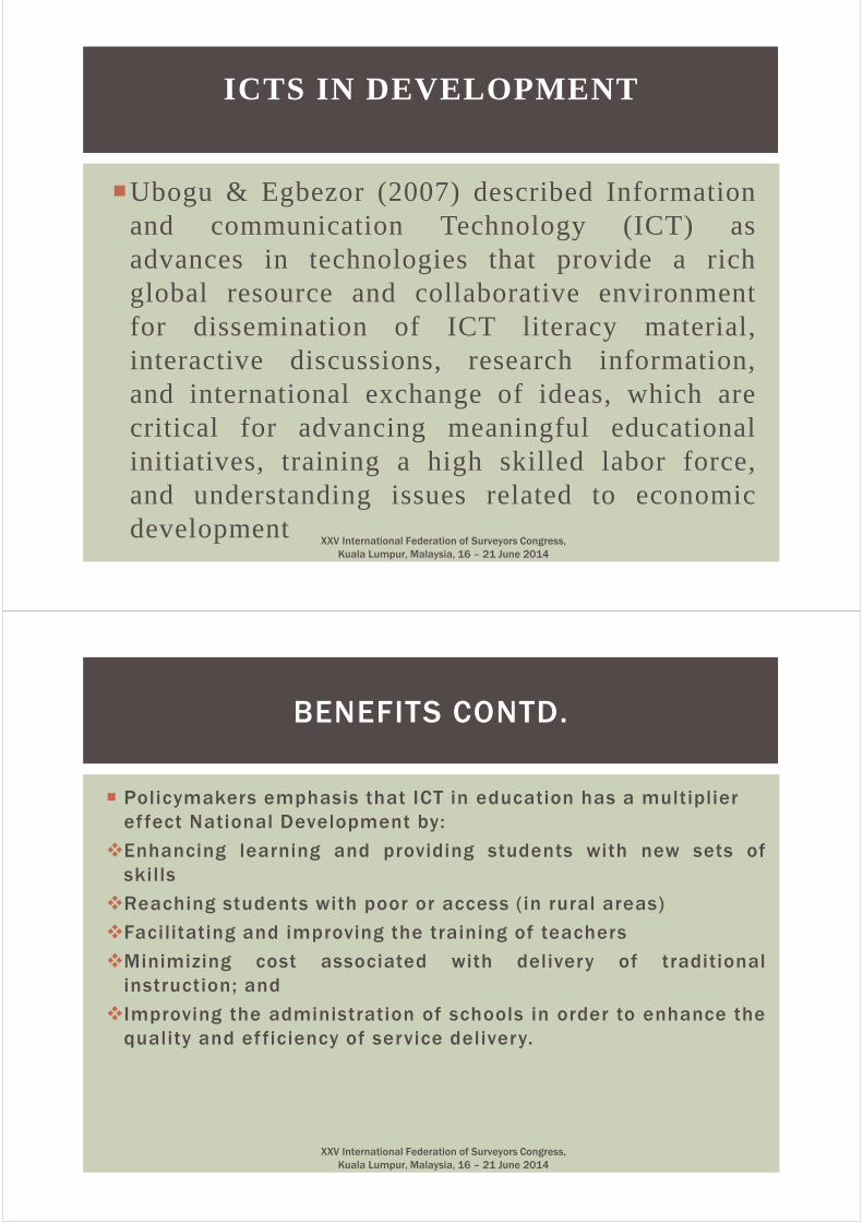
Chalk-and-board has longruled the classrooms
wil l not be el iminatedLess emphasis
Interactive Digital Content:•more emphasis•on demand learning•interactive
Evolution of Education Technology
Source: RTM TECHNOLOGIES
XXV International Federation of Surveyors Congress,
Kuala Lumpur, Malaysia, 16 – 21 June 2014
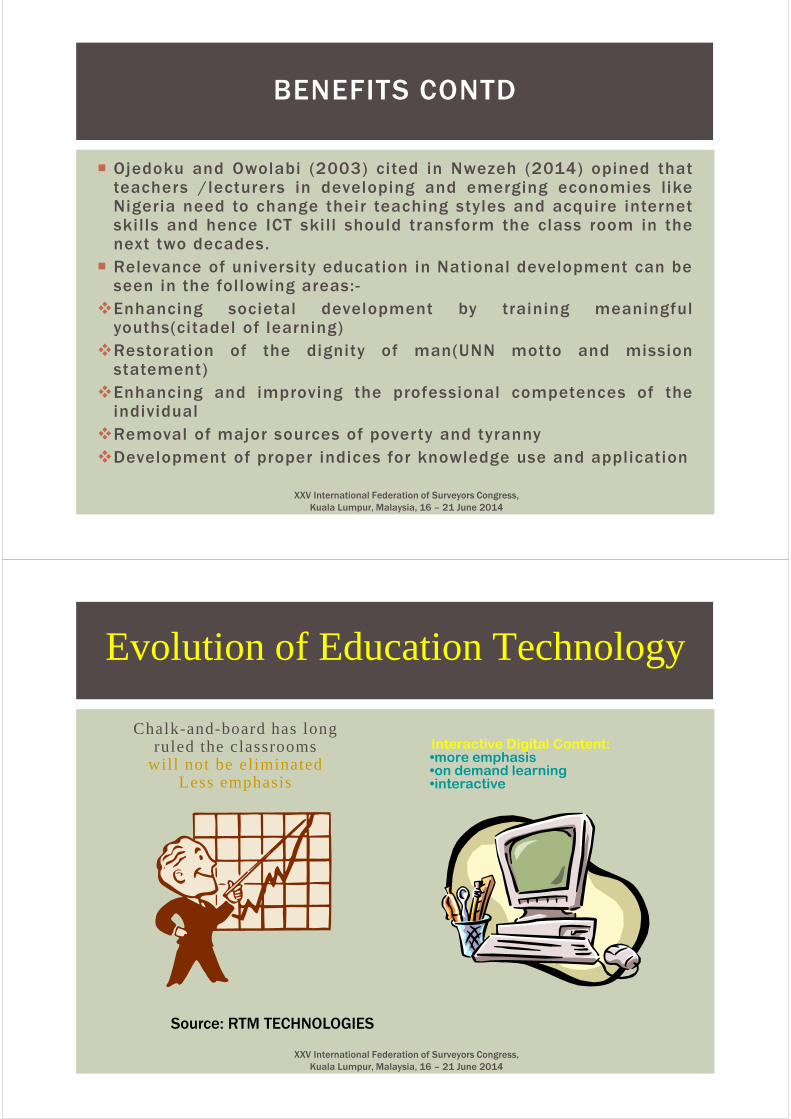
ICT EDUCATION VISION
XXV International Federation of Surveyors Congress,
Kuala Lumpur, Malaysia, 16 – 21 June 2014
� ICT/Digital Literacy:
� ICT infrastructure and support Applied Technologies
� Specialized Business and Industry Uses of ICT
� Bioscience industries� Financial institutions � Manufacturing industries
� Property management
� Telecommunications
� Electricity utilities
� In teaching and learning (e-learning)
DIMENSIONS TO ICT IN EDUCATION
XXV International Federation of Surveyors Congress,
Kuala Lumpur, Malaysia, 16 – 21 June 2014
AIM� Owing to the importance of
ICT in the field of Surveyingand Geoinformatics, there isneed to develop a competentworkforce through adequateeducation and training thatunderstands not only relevanttechnologies, but alsospecialized business andindustry environment andoperations, to meet thesespecialized needs in SouthEastern Nigeria.
OBJECTIVES
� The above aim will be
realized by harnessing
the potentials of ICT in
Surveying and
Geoinformatics training
and practice.
� Ensuring that responsible
digital citizenship is
established amongst the
young ones.
AIM & OBJECTIVE OF THIS STUDY
XXV International Federation of Surveyors Congress,
Kuala Lumpur, Malaysia, 16 – 21 June 2014
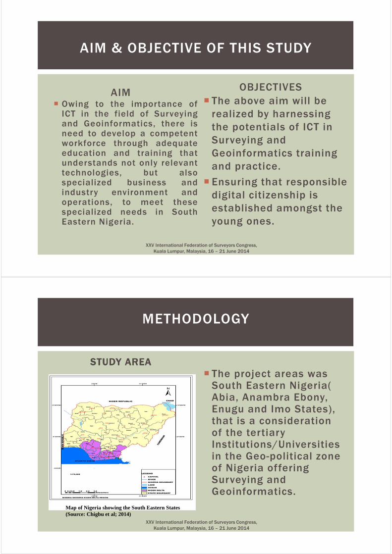
STUDY AREASTUDY AREASTUDY AREASTUDY AREA
� The project areas was South Eastern Nigeria( Abia, Anambra Ebony, Enugu and Imo States), that is a consideration of the tertiary Institutions/Universities in the Geo-political zone of Nigeria offering Surveying and Geoinformatics.
METHODOLOGY
Map of Nigeria showing the South Eastern States (Source: Chigbu et al; 2014)
XXV International Federation of Surveyors Congress,
Kuala Lumpur, Malaysia, 16 – 21 June 2014
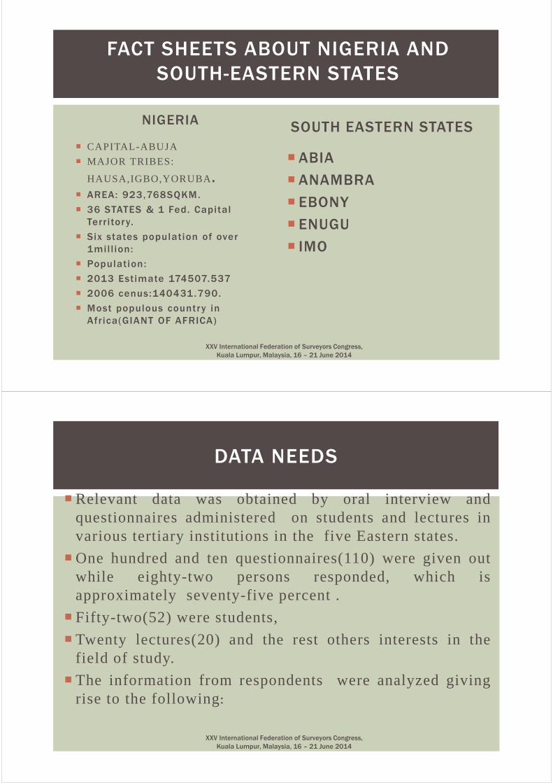
NIGERIA
� CAPITAL-ABUJA
� MAJOR TRIBES:
HAUSA,IGBO,YORUBA.� AREA: 923,768SQKM.
� 36 STATES & 1 Fed. Capital
Territory.
� Six states population of over
1mil l ion:
� Population:
� 2013 Estimate 174507.537
� 2006 cenus:140431.790.
� Most populous country in
Africa(GIANT OF AFRICA)
SOUTH EASTERN STATES
� ABIA
� ANAMBRA
� EBONY
� ENUGU
� IMO
FACT SHEETS ABOUT NIGERIA AND
SOUTH-EASTERN STATES
XXV International Federation of Surveyors Congress,
Kuala Lumpur, Malaysia, 16 – 21 June 2014
� Relevant data was obtained by oral interview andquestionnaires administered on students and lectures invarious tertiary institutions in the five Eastern states.
� One hundred and ten questionnaires(110) were given outwhile eighty-two persons responded, which isapproximately seventy-five percent .
� Fifty-two(52) were students,
� Twenty lectures(20) and the rest others interests in thefield of study.
� The information from respondents were analyzed givingrise to the following:
DATA NEEDS
XXV International Federation of Surveyors Congress,
Kuala Lumpur, Malaysia, 16 – 21 June 2014
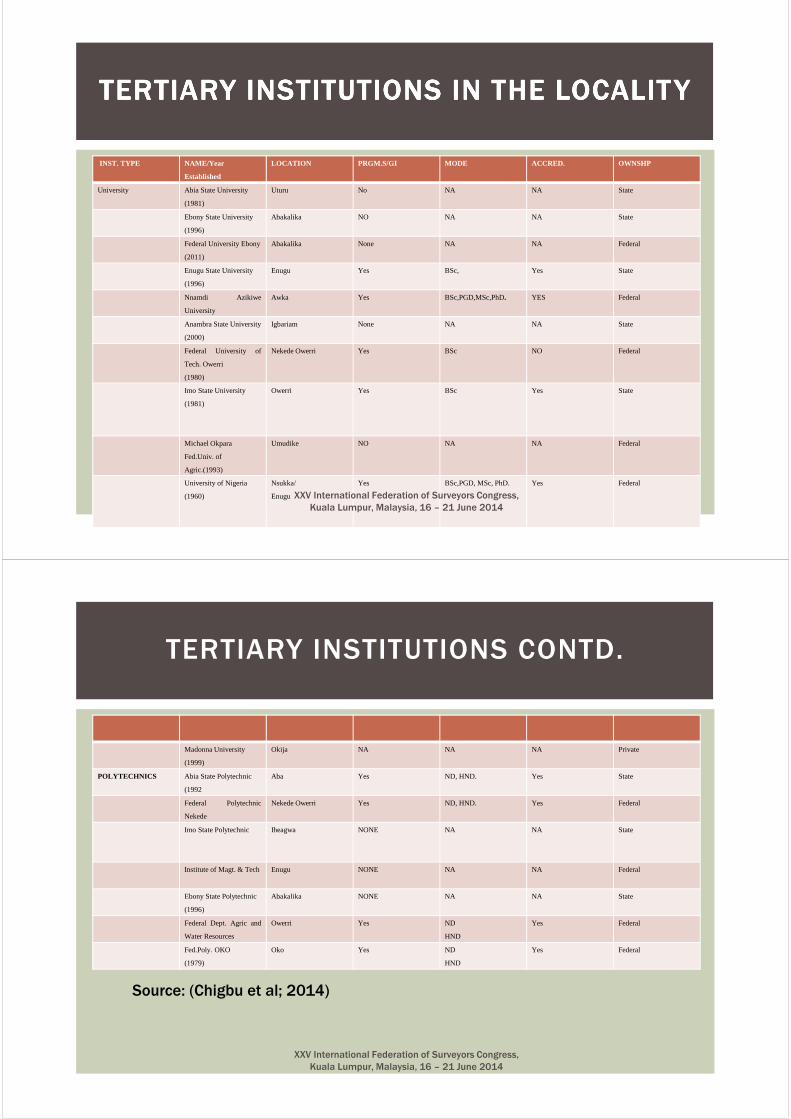
INST. TYPE NAME/Year
Established
LOCATION PRGM.S/GI MODE ACCRED. OWNSHP
University Abia State University
(1981)
Uturu No NA NA State
Ebony State University
(1996)
Abakalika NO NA NA State
Federal University Ebony
(2011)
Abakalika None NA NA Federal
Enugu State University
(1996)
Enugu Yes BSc, Yes State
Nnamdi Azikiwe
University
Awka Yes BSc,PGD,MSc,PhD. YES Federal
Anambra State University
(2000)
Igbariam None NA NA State
Federal University of
Tech. Owerri
(1980)
Nekede Owerri Yes BSc NO Federal
Imo State University
(1981)
Owerri Yes BSc Yes State
Michael Okpara
Fed.Univ. of
Agric.(1993)
Umudike NO NA NA Federal
University of Nigeria
(1960)
Nsukka/
Enugu
Yes BSc,PGD, MSc, PhD. Yes Federal
TERTIARY INSTITUTIONS IN THE LOCALITYTERTIARY INSTITUTIONS IN THE LOCALITYTERTIARY INSTITUTIONS IN THE LOCALITYTERTIARY INSTITUTIONS IN THE LOCALITY
XXV International Federation of Surveyors Congress,
Kuala Lumpur, Malaysia, 16 – 21 June 2014
Madonna University
(1999)
Okija NA NA NA Private
POLYTECHNICS Abia State Polytechnic
(1992
Aba Yes ND, HND. Yes State
Federal Polytechnic
Nekede
Nekede Owerri Yes ND, HND. Yes Federal
Imo State Polytechnic Iheagwa NONE NA NA State
Institute of Magt. & Tech Enugu NONE NA NA Federal
Ebony State Polytechnic
(1996)
Abakalika NONE NA NA State
Federal Dept. Agric and
Water Resources
Owerri Yes ND
HND
Yes Federal
Fed.Poly. OKO
(1979)
Oko Yes ND
HND
Yes Federal
TERTIARY INSTITUTIONS CONTD.
Source: (Chigbu et al; 2014)
XXV International Federation of Surveyors Congress,
Kuala Lumpur, Malaysia, 16 – 21 June 2014
UNIV/ITEMS FUTO NAU UNN MAU FED EBONY
Lecturers 9 11 12 NA NA
Average student Intake 33 50 40 NA NA
Graduate intake NA 40 35 NA NA
Virtual Library NA 1 1 NA NA
Equipment/Hardware
2Total Stations, DGPS, DLevels, others.>30 computers
>5 Total Stations,Scanners,DGPS, DLevels, others,1 GIS LAB, STUDIOS,1 R/S LAB>40 computers
>25 Total Stations, Scanners, DGPS DLevels, >60 computers.
NA NA
Funding Federal Federal Federal - Federal
Affiliation UNKNOWN FIG ACADEMIC MEMBER,ISPRS,etc.
FIG - -
Source of Power PHCNGen. Set
PHCNGen. Set
PHCNGen. Set
PHCNGen. Set
PHCNGen. Set
LEVEL OF ICT COMPLIANCE IN THE TERTIARY INST ITUT IONS (FED.
UNIVERSIT IES) IN S/E NIGERIA
Source: (Chigbu et al; 2014)XXV International Federation of Surveyors Congress,
Kuala Lumpur, Malaysia, 16 – 21 June 2014
UNIV/ITEMS ABSU ESUTH EBONY ANANBRA IMSU
Lecturers NA 7 NA NA 8
Average student Intake NA 45 NA NA 28
Graduate intake NA NA NA NA NA
Virtual Library NA NONE NONE NA NA
Equipment/Hardware
NA >2Total Stations, ,DGPS, DLevels, others,1 GIS LAB, STUDIOS,1 R/S LAB
NA NA NA
Software Usage NA ArcGIS,Erdas,AutoCad,ILWIS,ANNOVA,QGIS,MATHLAB,etc.
ArcGIS,Erdas,AutoCad,ILWIS,SPRING,QGIS,MATHLAB,etc.
NA NA
Funding STATE,TET FUND STATE STATE STATE STATE
Affiliation UNKNOWN UNKNOWN. UNKNOWN - -
Source of Power PHCNGen. Set
PHCNGen. Set
PHCNGen. Set
PHCNGen. Set
PHCNGen. Set
LEVEL OF ICT COMPLIANCE IN THE TERTIARY INSTITUTIONS (STATE UNITIES) IN S/E NIGERIA
Source: (Chigbu et al; 2014)XXV International Federation of Surveyors Congress,
Kuala Lumpur, Malaysia, 16 – 21 June 2014
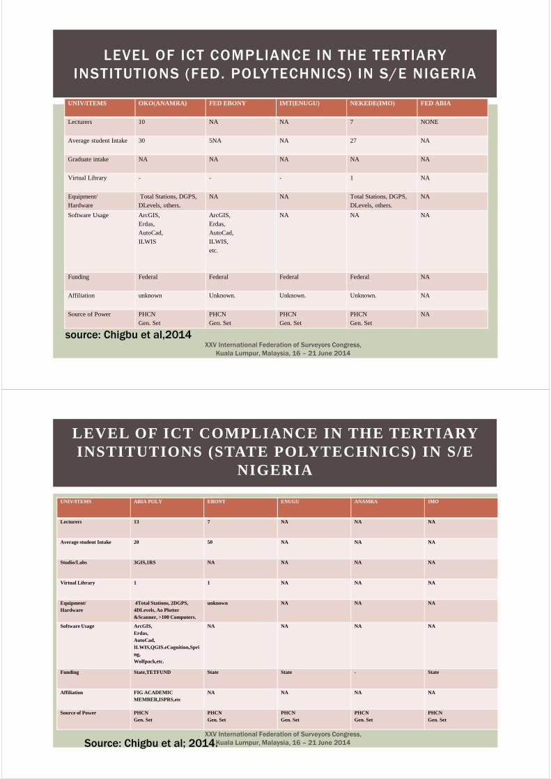
UNIV/ITEMS OKO(ANAMRA) FED EBONY IMT(ENUGU) NEKEDE(IMO) FED ABIA
Lecturers 10 NA NA 7 NONE
Average student Intake 30 5NA NA 27 NA
Graduate intake NA NA NA NA NA
Virtual Library - - - 1 NA
Equipment/Hardware
Total Stations, DGPS, DLevels, others.
NA NA Total Stations, DGPS, DLevels, others.
NA
Software Usage ArcGIS,Erdas,AutoCad,ILWIS
ArcGIS,Erdas,AutoCad,ILWIS, etc.
NA NA NA
Funding Federal Federal Federal Federal NA
Affiliation unknown Unknown. Unknown. Unknown. NA
Source of Power PHCNGen. Set
PHCNGen. Set
PHCNGen. Set
PHCNGen. Set
NA
LEVEL OF ICT COMPLIANCE IN THE TERTIARY
INSTITUTIONS (FED. POLY TECHNICS) IN S/E NIGERIA
source: Chigbu et al,2014XXV International Federation of Surveyors Congress,
Kuala Lumpur, Malaysia, 16 – 21 June 2014
UNIV/ITEMS ABIA POLY EBONY ENUGU ANAMRA IMO
Lecturers 13 7 NA NA NA
Average student Intake 20 50 NA NA NA
Studio/Labs 3GIS,1RS NA NA NA NA
Virtual Library 1 1 NA NA NA
Equipment/Hardware
4Total Stations, 2DGPS, 4DLevels, Ao Plotter &Scanner, >100 Computers.
unknown NA NA NA
Software Usage ArcGIS,Erdas,AutoCad,ILWIS,QGIS.eCognition,Spring,Wolfpack,etc.
NA NA NA NA
Funding State,TETFUND State State - State
Affiliation FIG ACADEMIC MEMBER,ISPRS,etc
NA NA NA NA
Source of Power PHCNGen. Set
PHCNGen. Set
PHCNGen. Set
PHCNGen. Set
PHCNGen. Set
LEVEL OF ICT COMPLIANCE IN THE TERTIARY INSTITUTIONS (STATE POLYTECHNICS) IN S/E
NIGERIA
Source: Chigbu et al; 2014.XXV International Federation of Surveyors Congress,
Kuala Lumpur, Malaysia, 16 – 21 June 2014
� Based on the above findings and information the following can
be deduced:
� The number of Lecturers in most of the are not very commendable.
� It is the human capacity that will be the driving force in thiscampaign.
� Again, the average student intake( which is less than 40 persession per school) is grossly inadequate, meaning that, theprofession is not admitting the required number of studentsandhence, the succession plan for the profession in the for the futureis very poor. This is a very bad signal
DATA ANALYSIS
XXV International Federation of Surveyors Congress,
Kuala Lumpur, Malaysia, 16 – 21 June 2014
� The facilities for good research work are also not readily
available as funding too is poor.
� The research also went further to reveal that the extent of The research also went further to reveal that the extent of The research also went further to reveal that the extent of The research also went further to reveal that the extent of
lecturers’ utilization of the ICT facilities is very low. lecturers’ utilization of the ICT facilities is very low. lecturers’ utilization of the ICT facilities is very low. lecturers’ utilization of the ICT facilities is very low.
� This This This This is sequel to lack of electricity power supply, lack of basic is sequel to lack of electricity power supply, lack of basic is sequel to lack of electricity power supply, lack of basic is sequel to lack of electricity power supply, lack of basic
computer operational skills etccomputer operational skills etccomputer operational skills etccomputer operational skills etc....
� Incessant power failure is also serious impediment to ICT implementation.
� The libraries in the tertiary institutions in south eastern Nigeria showed that they are grossly under funded with respect to adopting ICT development.
DATA ANALYSIS CONTD.
XXV International Federation of Surveyors Congress,
Kuala Lumpur, Malaysia, 16 – 21 June 2014
�Recommendation
� Conscious planning
of ICT usage in our
schools and tertiary
institutions.
�Adequate budgeting
for ICT development
in our schools
advocated.
� ICT utilization in
Surveying and
Geoinformatics
discipline must be
encouraged to
develop good
professional literate
persons.
RECOMMENDATION AND CONCLUSION RECOMMENDATION AND CONCLUSION RECOMMENDATION AND CONCLUSION RECOMMENDATION AND CONCLUSION
XXV International Federation of Surveyors Congress,
Kuala Lumpur, Malaysia, 16 – 21 June 2014
� A strategy for Collaborations amongst tert iary insti tutions running Surveying and Geoinformatics is also recommended.
� This can be on national, regional and International basis.
� FIG, WORLD BANK, INTERNATIONAL SERVICE PROVIDERS need to encourage aff i l iated insti tut ion in the Sub-Saharan especially those that have constantly fulf i l led their f inancial obl igations to FIG (ACADEMIC MEMBERS).
� .
� Such Inst i tut ions and Departments can be encouraged through donat ions such as text books, survey equipment, sponsorships and t raining to bui ld capaci ty
RECOMMENDATION CONTDS.
XXV International Federation of Surveyors Congress,
Kuala Lumpur, Malaysia, 16 – 21 June 2014
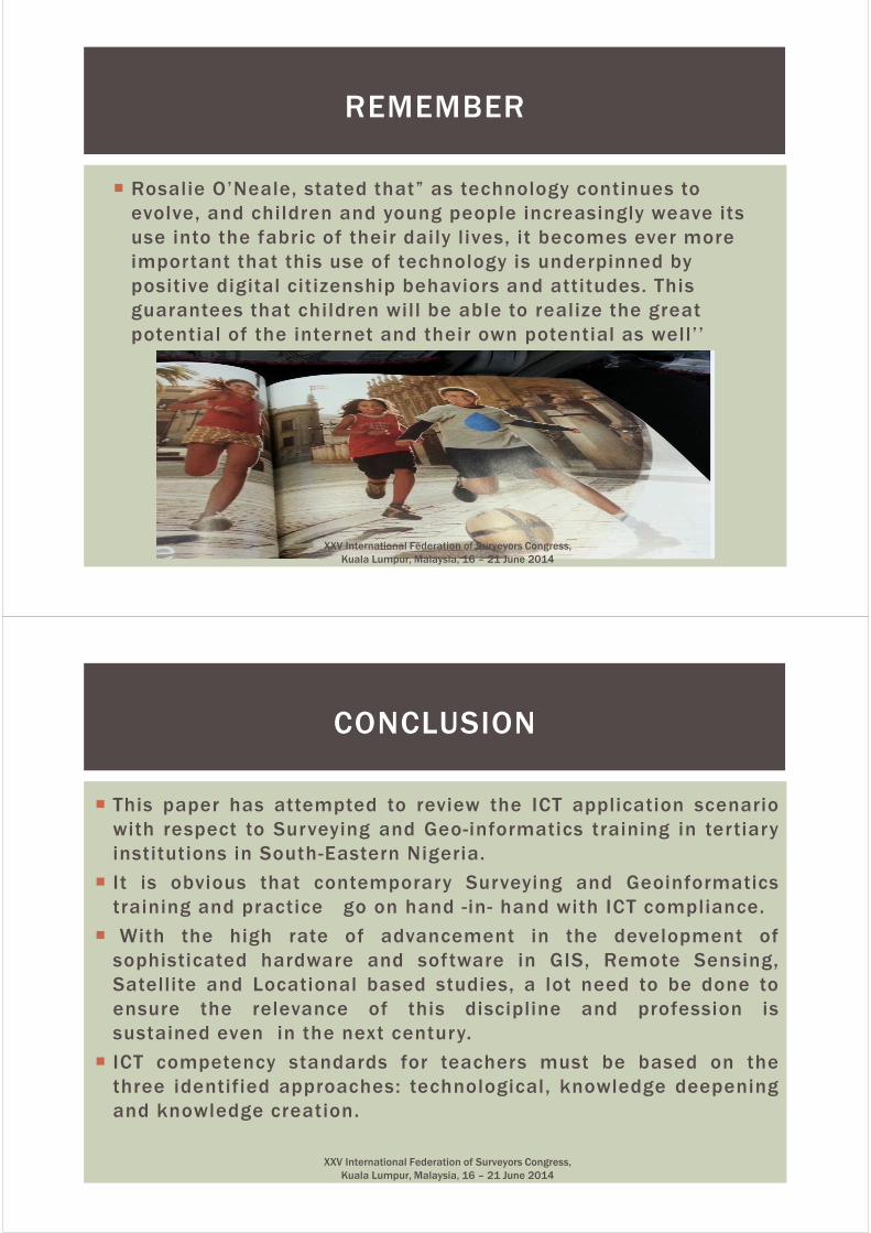
� Rosalie O’Neale, stated that” as technology continues to
evolve, and children and young people increasingly weave its
use into the fabric of their daily l ives, it becomes ever more
important that this use of technology is underpinned by
positive digital citizenship behaviors and attitudes. This
guarantees that children will be able to realize the great
potential of the internet and their own potential as well’’
REMEMBER
XXV International Federation of Surveyors Congress,
Kuala Lumpur, Malaysia, 16 – 21 June 2014
� This paper has attempted to review the ICT application scenario
with respect to Surveying and Geo-informatics training in tertiary
institutions in South-Eastern Nigeria.
� It is obvious that contemporary Surveying and Geoinformatics
training and practice go on hand -in- hand with ICT compliance.
� With the high rate of advancement in the development of
sophisticated hardware and software in GIS, Remote Sensing,
Satellite and Locational based studies, a lot need to be done to
ensure the relevance of this discipline and profession is
sustained even in the next century.
� ICT competency standards for teachers must be based on the
three identified approaches: technological, knowledge deepening
and knowledge creation.
CONCLUSION
XXV International Federation of Surveyors Congress,
Kuala Lumpur, Malaysia, 16 – 21 June 2014
WE CAN
XXV International Federation of Surveyors Congress,
Kuala Lumpur, Malaysia, 16 – 21 June 2014
� BIBLIOGRAPHICAL NOTES:� Ch igbu N j i ke CHIGBU NJ IKE i s t he head o f Su rveying and Geo in fo rmat i cs Dep t . o f Ab ia S ta te
Po lytechn i c , Aba i n N iger i a . He has a Bache lo r ’s and Mas te r ’s Degree i n Surveying and Geo in fo rmat i cs f rom Un ive rs i t y o f N iger i a and Nnamdi Az i k iwe Un ive rs i t y, Awka , a l l i n N iger i a , respec t i ve l y. He has a l so comp le ted h i s doc to ra l Degree cou rse work i n Su rveying and Geo in fo rmat i cs . H i s research i n te res ts a re i n a reas o f GNSS app l i ca t i ons , Remote Sens ing Image p rocess ing , app l i ca t i on o f Geo-spa t i a l Sc ience i n Env i ronmen ta l Management and P lann ing . He i s an ac t i ve member o f F IG Commiss ion 2 & 3 and A f r i can Task Fo rce (ATF) .He i s a l so an ac t i ve Member o f N iger i an Ins t i t u t i on o f Su rveyo rs (N IS ) . Mar r i ed to Mrs . J enn i fe r Ez iaku Ch igbu and they a re b lessed w i th t h ree k ids (C l i n ton , Che lsea and Campbe l l ) .
� Emai l : n j i kec@gmai l . com� PHONE +2348033423624
� Onukaogu Danie l Chukw uemeka i s a graduate of GIS and a lec turer I I I w i th depar tment o f Surveying and Geoinformat ics . His in terests in locat ion based s tud ies, SDI and spat ia l in format ion sc ience.
� Emai l : danie [email protected]� PHONE: +2348175705891
� APEH MICHAEL: He is a senior Technologist wi th Federal Polytechnic Idah, KOGI State of Niger ia. He has a HND and M.Sc. in Geoinformatics .His research in terest is in the area of appl icat ion of GIS in Environmental Management. He is marr ied and b lessed wi th two k ids
� Emai l : mimapeh@gmail .com�
� PHONE: +23480568446365
BIBLIOGRAPHICAL NOTES
XXV International Federation of Surveyors Congress,
Kuala Lumpur, Malaysia, 16 – 21 June 2014
� Ebiwolate (2010) : Niger ian l ibrar y ser v ice to rura l areas : l ibrar ies in Niger -De l ta s tates . L ibrar y Phi losophy and Pract ice . Avai lab le : h t tp ://unl l ib .unl .edu/LPP/pos igha .htm
� Enemark , S . (2006) : The e -Future Chal lenge , In Markus B . : E -Governance , Knowledge
� Management and e -Learning , Internat iona l F IG Workshop, Budapest , Hungar y.
� ICT, A gr icu l ture sourcebook: avai lab le f rom onl ine : h t tp ://www. ict inagr icu l ture .org/sourcebook/module -14 - ic t - land-admin is t ra t ion -and -management
� Markus B . (2008) : Th inking about e -Learning , Shar ing Good Pract ices : E - learning in Sur vey ing , Geo- in format ion Sc iences and Land Adminis t ra t ion, F IG Internat iona l Workshop , Enschede, The Nether lands
�
� Ndukwe (2008) : Leverag ing Informat ion Technology for South East Economic Renaissance
�
� Nwezeh Ch inwe M.T. (2014) : The Use of ICT in Niger ian Univers i t ies . A case s tudy of Obafemi Awolowo Univers i t y I le - I fe . ( i ssn 1522-0222) (www.webpages .u idalw.edu/m) -Accessed on 02/5/2014) .
�
� Olulube , N .P. ; Udogu, A .E . & Ossai , A .G. (2006) : . ICTs and the ef fects o f g lobal i zat ion : twenty f i rs t centur y "d ig i ta l s laver y” for develop ing countr ies myth or rea l i ty? Accessed f rom ht fo ://ww.ca ls ta te . Edu/st ra teg ic .Html .
�
REFERENCES
XXV International Federation of Surveyors Congress,
Kuala Lumpur, Malaysia, 16 – 21 June 2014
� Sara Hennessey and Leonard Wamakote (2010): Teachers Factors Influencing Classroom Use of ICT in Sub-Saharan Africa. Hupale Online Journal of Afr ican Studies 2, ISSN 2043-6165. Accessed on 2/05/2014: http://www.hennessy_et alfinal.pdf.
�
� Thompson, B. , and A . Waller (2011): The Role of Cloud Computing in Commercial Property. Coventry: Royal Institute of Char tered Surveyors (RICS).
�
� Ubogu & Egbezor (2007) ICT and distance Education programs in a Sub-Saharan African Country: A Theoretical Perspective. Journal of Information Technology Impact VOl7, No3, pp.181-194, 2007
� UNESCO (2002): Information and communication technologies in teacher education: a planning guild. http://www. unesco.ors.
�
� UNESCO. (2008).ICT Competency Standards for Teachers –Implementation Guidelines. Version1.0. Accesses on 24 th May.2014 from http://www.unesco.or/en/competency -standards Teachers
REFERENCES CONTD.
XXV International Federation of Surveyors Congress,
Kuala Lumpur, Malaysia, 16 – 21 June 2014