developing applications & services using space … applications & services using space...
TRANSCRIPT

Developing Applications & Services
Using Space Assets
Alan Brunstrom Head of the Applications Business Office, ESA Harwell Centre
[email protected] 01235 567 903

ESA applications development programmes
• ARTES (Advanced Research in Telecommunications): • UK is a leading contributor through the TSB • Integrated Applications Promotion (IAP) or ARTES 20
– The main topic of this presentation
• ARTES APPS (or ARTES 3-4 applications) – Technology development, both of satellites (Inmarsat Alphasat, Avanti Hylas)
and ground elements e.g. user terminals – Applications development element, for telecoms oriented projects – Continuously open call, 50% funding.
• Value Added Element for Earth Observation – Applications development using earth observation satellites – Annual work plan and periodic focused calls – Run by ESA’s Earth Observation Directorate, from Esrin in Italy – UK is a major contributor through NERC & National Centre for Earth Observation.

ESA Integrated Applications Promotion
– Objective: – To develop operational services for a wide range of
users by combining different systems.
We do this by: – Responding to actual user needs; – Working with a wide range of stakeholders; – Exploring the capacity of space assets beyond the current
state-of-the-art; – Combining multiple existing space assets with terrestrial
systems; – Emphasising sustainable applications and services.
Transport Health Safety Energy Development …

IAP System of Systems example
Disaster zone
Navigation and positioning satellite
Field teams
Field base
Telecommunications satellite
Telecommunications service provider
Base
Crisis management centre
Earth observation satellite
Earth observation data provider
DRS
Telemedicine
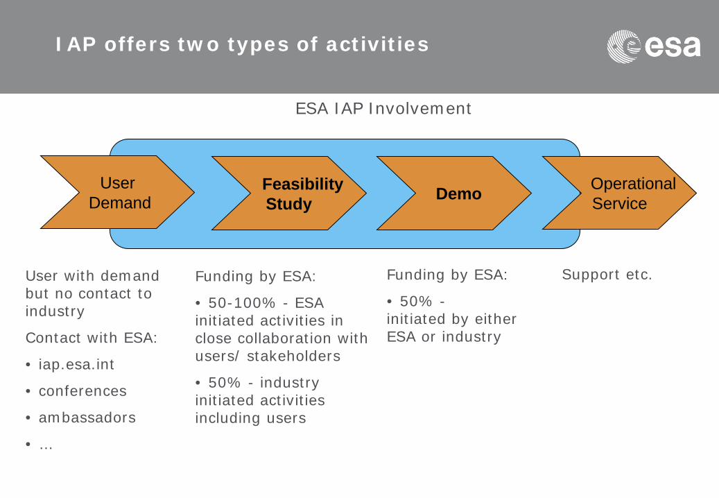
IAP offers two types of activities
User Demand
Feasibility Study Demo Operational
Service
User with demand but no contact to industry
Contact with ESA:
• iap.esa.int
• conferences
• ambassadors
• …
Funding by ESA:
• 50-100% - ESA initiated activities in close collaboration with users/ stakeholders
• 50% - industry initiated activities including users
Funding by ESA:
• 50% - initiated by either ESA or industry
ESA IAP Involvement
Support etc.

Funding: Option 1 – Direct Negotiation
– Industrial consortium with user partner(s) involved – Direct negotiation with ESA (iterative process)
– Process: – Outline Proposal Complete Proposal
– Funding: – Feasibility Studies and Demo projects co-funded by 50%
– For Feasibility Studies: Research institutions or Universities can apply for 100% funding if no commercial interest in outcome of the project
– Support/authorisation needed from national ESA delegates

Funding: Option 2 – Open Competition
– User partner with demand but no contact to industry – Cooperation agreement with ESA
– Co-funding from user is desirable
– Process: 1. Invitation to Tender (open competition)
2. Full Proposals submitted by industry consortia
3. ESA looks for best solution
– Funding: – Feasibility Studies: fully funded – ESA funds between 50%
and 100%, depending on level of user co-funding
– Demo projects: ESA co-funding 50%
– Support/authorisation from national ESA delegates

Open competition approach to achieve user-driven service development
Call for
proposals
Consolidation of user
requirements
Call for user ideas
SOW
TEB Feasibility
Study
Open competition process between industry
Bilateral consolidation of requirements (Users & ESA) ESA internal
evaluation
ESA internal user federation
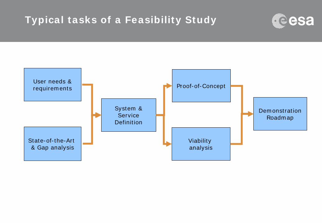
Typical tasks of a Feasibility Study
User needs & requirements
State-of-the-Art & Gap analysis
System & Service
Definition
Proof-of-Concept
Viability analysis
Demonstration Roadmap
Telecommunications and Integrated Applications
IAP Case Studies: a selection of projects with UK
participants
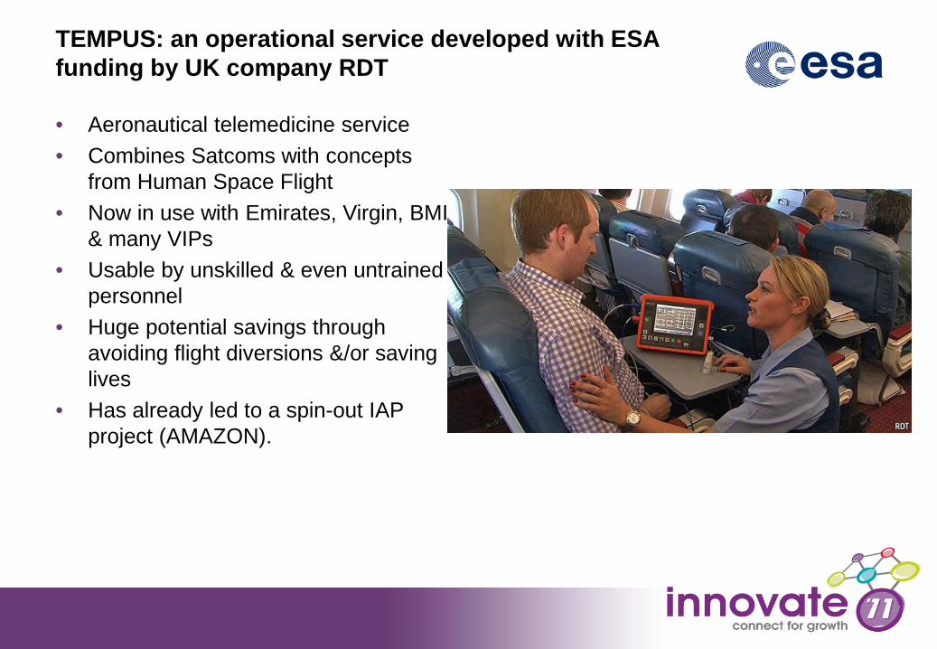
TEMPUS: an operational service developed with ESA funding by UK company RDT
• Aeronautical telemedicine service • Combines Satcoms with concepts
from Human Space Flight • Now in use with Emirates, Virgin, BMI
& many VIPs • Usable by unskilled & even untrained
personnel • Huge potential savings through
avoiding flight diversions &/or saving lives
• Has already led to a spin-out IAP project (AMAZON).

12
• Development of a portable medical system supporting traditional diagnostic monitoring of vital signs, plus other telemedicine applications.
• Reduces costs by avoiding MedEvacs from remote sites. • Ease of use allows use by lower-skilled staff (e.g. nurse instead of doctor) in remote
locations, improving margins and/or enabling additional sites. • Developed & trialed in partnership with International SOS. • Pilot phase involving remote clinical sites in Nigeria and Algeria.
AMAZON
12
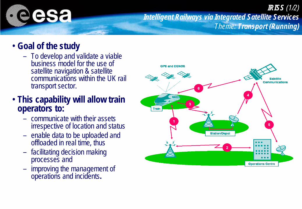
IRISS (1/2) Intelligent Railways via Integrated Satellite Services
Theme: Transport (Running)
• Goal of the study – To develop and validate a viable
business model for the use of satellite navigation & satellite communications within the UK rail transport sector.
• This capability will allow train operators to:
– communicate with their assets irrespective of location and status
– enable data to be uploaded and offloaded in real time, thus
– facilitating decision making processes and
– improving the management of operations and incidents.

Phase Description Timing
1 IAP pre-feasibility study
• Identify & specify the range of services & user requirements for an integrated information, communication & navigation gateway within the rail transport sector
• Validate the potential of the long term objectives.
2009 (done)
2 Feasibility study
• Identify the technical options & solutions to implement the integrated services selected by end-users
• experimentation with the end-users using a proof of concept test-bed integrating satnav, satcom & terrestrial wireless communications.
2010 Current
3 Demo project
• Deployment & pre-operations • Extensions to other countries?
2011
Train tracking software (courtesy of NSL)
IRISS (2/2) Intelligent Railways via Integrated Satellite Services
Theme: Transport (running)
• Stakeholders involved: – NSL, Avanti, AST Rail, Scisat – East Midlands Trains

15
FishSAT & North Sea Fisheries Projects (1/2) Sustainable Fishing
• Fisheries monitoring authorities: – control the TAC limits by monitoring the catches of the fishing boats – safeguard ecosystems (e.g. prevent boats from entering forbidden areas) – increase fishing boat safety – prevent illegal competition, e.g. from foreign boats.
• Background: – Concern about ecological impact and sustainability of fisheries; – Need for prevention and control of boats fishing in prohibited areas,
adopting illegal methods and exceeding quotas; – Wastage and sub-optimal revenues due to lack of real time
information about prices for each species in different auctions. Example of fish density map

16
• Added-value of space: – Earth observation data:
• (ocean colour, chlorophyll concentration, etc.) for the detection and forecast of fish;
• Meteorological data for weather information.
– Satellite Navigation for positioning, geo-fencing, tracking and geo-location of collected data;
– Satellite Communications: real-time communications to update maps, communicate with fish markets and information databases.
FishSAT & North Sea Fisheries Projects (2/2) Sustainable Fishing
• Objectives of the Feasibility Studies:
– The development of integrated satellite based services: a) to support fisheries providing
• operational information • fish marketing support e.g.
current prices at auctions b) to support fisheries protection
authorities
• Stakeholders involved e.g.: – Fishing associations
(Netherlands, Italy, UK) – Coast guard (Italy) – Fish auctions (Netherlands, UK) – Supermarkets and wholesalers
(UK)
Proposed service scheme

The VECMAP project
Disease vector mapping
• Outbreaks of Chikungunya • Reunion 2005-2006 • Ravenna (Italy) 2007
• Global introductions of disease vectors • International trade (e.g. eggs in tyres) • Tourism • Global warming
• Need for surveillance, early warning systems & control • Vectors survive only in particular ecosystems • Need for spatial prediction maps
Asian Tiger Mosquito A. Albopictus, vector for: - West-Nile - Dengue - Chikungunya - Yellow fever - St. Louis Encephalitis

The VECMAP project
Users & their needs
1. Academic users 2. Public Health (decision makers) 3. Control agencies - Critical & nuisance species - Where are they (mosquitoes, larvae, eggs), high resolution - When will eggs hatch & population peak - Cover a greater area with the same budget - Use less pesticides
Control agencies -EID Mediterranee (F) -CAA (I) -CMV (NL)
The VECMAP project
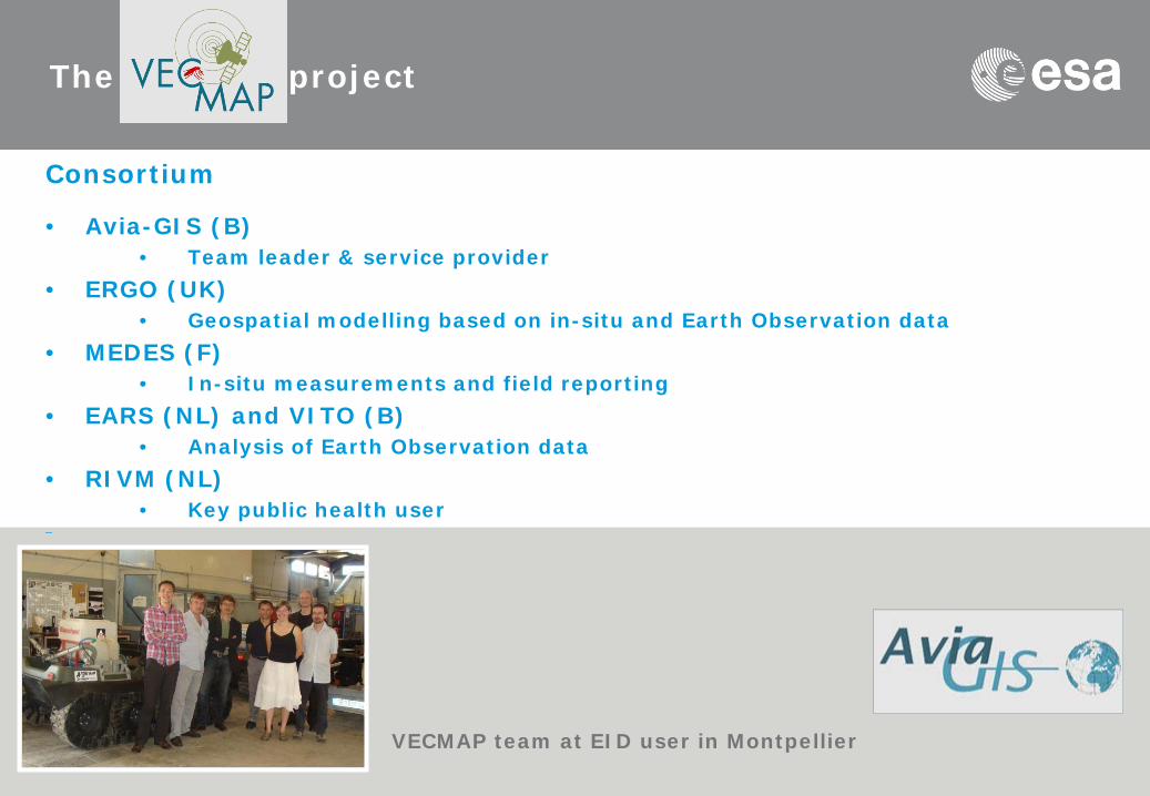
Consortium
• Avia-GIS (B) • Team leader & service provider
• ERGO (UK) • Geospatial modelling based on in-situ and Earth Observation data
• MEDES (F) • In-situ measurements and field reporting
• EARS (NL) and VITO (B) • Analysis of Earth Observation data
• RIVM (NL) • Key public health user
–
VECMAP team at EID user in Montpellier

The VECMAP project
VECMAP Services
• Sampling strategy & routing service • Field-data synchronization with dBase incl. GNSS position • Synchronization of laboratory data • Continuous set of processed EO data • Habitat suitability mapping service • Landscape suitability mapping service • GIS & raster functions by web interface
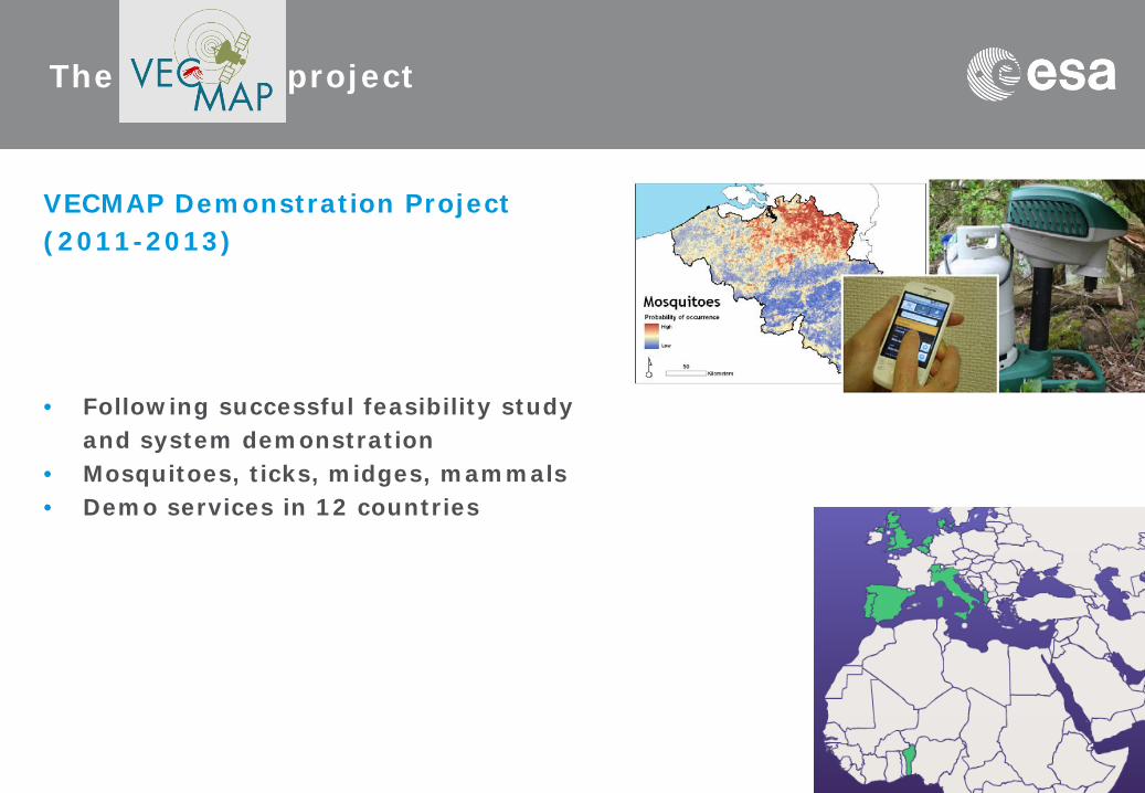
VECMAP Demonstration Project (2011-2013)
• Following successful feasibility study and system demonstration • Mosquitoes, ticks, midges, mammals • Demo services in 12 countries
The VECMAP project
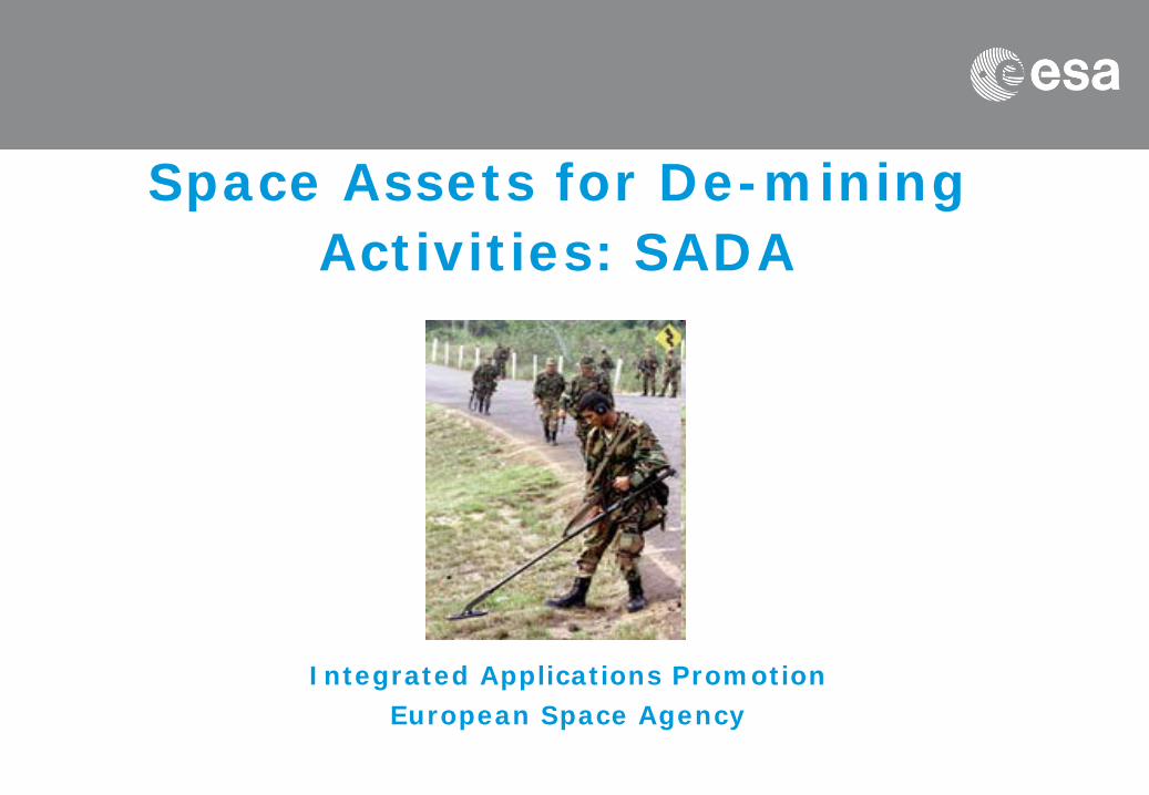
Space Assets for De-mining Activities: SADA
Integrated Applications Promotion European Space Agency
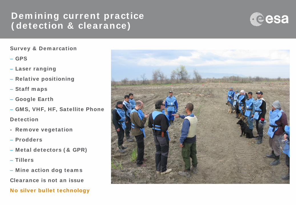
Demining current practice (detection & clearance)
Survey & Demarcation
– GPS
– Laser ranging
– Relative positioning
– Staff maps
– Google Earth
– GMS, VHF, HF, Satellite Phone
Detection
- Remove vegetation
– Prodders
– Metal detectors (& GPR)
– Tillers
– Mine action dog teams
Clearance is not an issue
No silver bullet technology
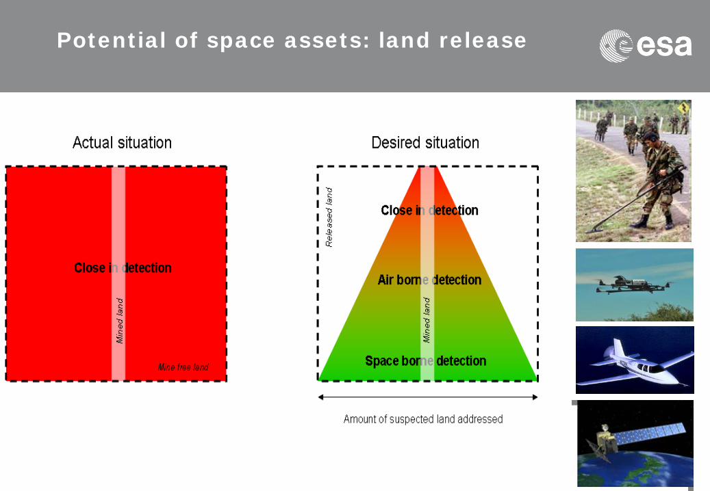
Potential of space assets: land release

Potential of space asset integration: ARC, 2003
25
Powerline Access to streams
Forest edge
Trenches
Access to road/path
Minefield
Indicators Shore of river
Source: ARC Field Trial, May 2003
Mine Accidents Records
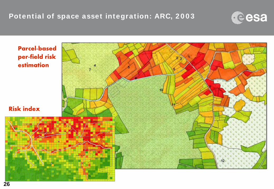
26
Risk index
Parcel-based
per-field risk
estimation
Potential of space asset integration: ARC, 2003
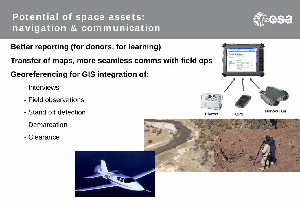
Better reporting (for donors, for learning)
Transfer of maps, more seamless comms with field ops
Georeferencing for GIS integration of: - Interviews
- Field observations
- Stand off detection
- Demarcation
- Clearance
Examples Potential of space assets: navigation & communication
GPS Photos
Bonoculars

Integrating Space Assets for UK Civil Resilience (1/2) Theme: Safety (running)
• Background: – Summer 2007 floods, worst of UK history – British resilience teams overloaded – Major government review on procedures and
strategies.
• UK Civil Contingencies Secretariat (CCS) new mandate after 2007 disaster:
– Identifying threats, assessing their nature and providing warnings
– Readiness to respond – Building greater resilience for the future – Providing leadership and guidance to the resilience
community

Integrating Space Assets for UK Civil Resilience (2/2) Theme: Safety (running)
• Feasibility study: – Identify space-based
services for UK Civil Contingencies
– Analyse current space and terrestrial capabilities.
– Prepare the way for the implementation of the most promising services
• Space Assets – EO data for prevention / monitoring / damage
assessment in real- or near-real time – Satellite Telecommunications to provide coverage
on damaged areas – Navigation for resource location

Imminent & Current Open Competitions
• Supporting services for the wind power industry – Wind energy output prediction – Onshore and offshore – Weather windows for offshore construction and maintenance
• Special meteorological services for maritime search and rescue • Piracy prevention and commercial navigation in insecure waters • Improvement of safety at railway level crossings • Services for ski resorts (ITT probably out in May) • Prediction, monitoring and alerting of landslides and subsidence
affecting the transport infrastructure – Focus on road & rail infrastructure in Scotland – User partners Transport Scotland and Network Rail – Contract with winning consortium under negotiation

ESA UNCLASSIFIED – For Official Use
UK Involvement in IAP Projects to date
1. UK suppliers are involved in 18 of the >50 IAP proposals that have so far been approved by the ESA Board.
2. There are UK primes on 12 of these activities: 8 proposals are UK-only & 10 are multi-national.
3. In total 35 UK suppliers are engaged, including 5 universities; half are from outside the space industry.
4. Around 10 projects also directly involve UK users. 5. The activities cover all major themes, with five services now
operational. 6. There is still money in the €14m budget for new projects. 7. We aim to expand the programme next year. 8. But where are the Scots….?
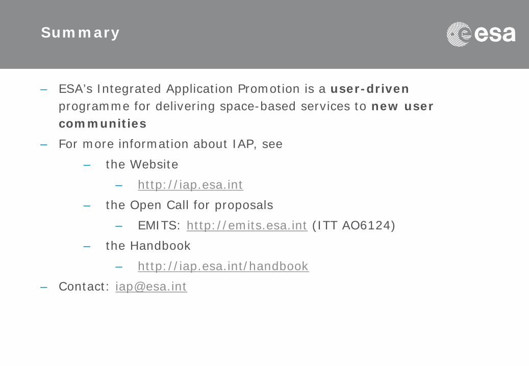
Summary
– ESA’s Integrated Application Promotion is a user-driven programme for delivering space-based services to new user communities
– For more information about IAP, see – the Website
– http://iap.esa.int – the Open Call for proposals
– EMITS: http://emits.esa.int (ITT AO6124) – the Handbook
– http://iap.esa.int/handbook – Contact: [email protected]