map cataloging basics
TRANSCRIPT

MAP CATALOGING: LEARNING THE BASICS
Saturday, June 16, 20019:00 am – 12:30 pm
San Francisco, California
Susan M. MooreUniversity of Northern Iowa
(319) [email protected]
and
Lucinda M. HallDartmouth College
(603) [email protected]
Handout Index
Resources………………………………………………………………………………….2
Major Differences between Book and Map Cataloging(Minus mathematical and physical descriptions)………………………………………….4
Scale……………………………………………………………………………………….8
Scale Exercises…………………………………………………………………………...12
Projection and Coordinates………………………………………………………………14
Measuring Examples……………………………………………………………………..15
How to Date a Road Map………………………………………………………………...16
Subject Headings………………………………………………………………………...20
Scale Exercises Answers………………………………………………………………...22
Prepared by Susan M. Moore, University of Northern Iowa
Map Cataloging: Learning the Basics2
RESOURCES
Cataloging Rules (in addition to AACR2rev.)
Cartographic materials : a manual of interpretation for AACR2 / prepared by the Anglo-American Cataloging Committee for Cartographic Materials. Chicago : ALA ; Ottawa : CLA,1982. ISBN 0-8389-0363-0 (ALA) ISBN 0-88802-169-0 (CLA) [Out of print; however a newedition will be coming out in 2001]
Map cataloging manual / prepared by the Geography and Map Division, Library of Congress.Washington, D.C. : Cataloging Distribution Service, Library of Congress, 1991. ISBN 087071-361-2 [Also available on Cataloger=s Desktop]
Maps and related cartographic materials : cataloging, classification, and bibliographic control /Paige G. Andrew and Mary Lynette Larsgaard, editors. New York : Haworth Press, 1999. ISBN0-7890-0778-9 (hbk.) ISBN 0-7890-08130 (pbk.) [also published as vol. 27, nos. 1/2 and 3/4 ofCataloging and Classification Quarterly]
Guidelines for distinguishing cartographic materials on computer file carriers from othermaterials on computer file carriers / prepared by the Library of Congress, Cataloging Policy andSupport Office, Network Development and MARC Standards Office, Geography and MapDivision, andSpecial Materials Cataloging Division. January 1998. On the Web at:http://lcweb.loc.gov/marc/cfmap.html
Natural Scale Indicator/Map Scale Indicator
Plastic version (approx. $5-$10 Heavy paper version (Possibly no cost)Department of Geography U.S. Department of CommerceMemorial University of Newfoundland National Oceanic & Atmospheric
AdministrationSt. John’s, Newfoundland A1B 3XP Canada National Ocean Service
Physical Science Services Branchhttp://www.mun.ca/geog/muncl/Products/msi.htm Rockville, MD 20852
For general information about maps and map librarianship
Map librarianship : an introduction / Mary Lynette Larsgaard. 3rd ed. Englewood, Colo. :Libraries Unlimited, 1998. ISBN 1-56308-474-0 (Includes a very extensive bibliography and alot of excellent information on cataloging issues as well as other aspects of map librarianship)
USGS maps (USGS brochure with examples of different types of maps and relief).Request from: USGS Map Distribution, Box 25286, Denver, CO 80225

Map Cataloging: Learning the Basics3
For information about mapmaking and/or map projections
Choosing a world map : attributes, distortions, classes, aspects / Committee on Map Projectionsof the American Cartographic Association. Falls Church, Va. : American Congress onSurveying and Mapping, c1988. Special Publication no. 2. ISBN 0-96134592-6
Map appreciation / Mark Monmonier, George A. Schnell. Englewood Cliffs, N.J. : PrenticeHall, c1988. ISBN 0-13-556052-7
Map projections : a reference manual / Lev M. Bugayevskiy, John P. Snyder. Bristol, PA :Taylor and Francis, 1995. ISBN 0-7484-0303-5
Map use : reading, analysis, and interpretation / Phillip C. Muehrcke, Juliana O. Muehrcke. 4thed. Madison, WI : JP Publications, c1998. ISBN 0-9602978-4-7
Matching the map projection to the need / Committee on Map Projections of the AmericanCartographic Association. Bethesda, Md. : American Congress on Surveying and Mapping,c1991. Special Publication no. 3. ISBN 0-9613459-5-0
Web resources
http://www.sunysb.edu/libmap/magert1.htm Map and Geography Round Table, AmericanLibrary Association / webmaster: David Allen.
http://www.tlcdelivers.com/tlc/crs/map0001.htm Map Cataloging Manual / content by theLibrary of Congress; hosted by The Library Corporation.
http://ucs.orst.edu/~reeset/tools.html Oregon State University Map Cataloging -- CartographicCataloging Tools / Terry Reese.
http://www.konbib.nl/kb/resources/frameset_kb.html?/kb/skd/skd/mathemat.html Mathematicaldata for bibliographic descriptions of cartographic material and spatial data / Jan Smits.
http://www.waml.org/maptools.html Western Association of Map Libraries' Map Librarian'sToolbox / Linda Zellmer.
Based on handouts prepared by Catherine Gerhart, University of Washington
Map Cataloging: Learning the Basics4
Major Differences between Book and Map Cataloging(minus Mathematical and Physical Description)
Note: AACR2=Anglo-American Cataloging Rules, 2nd ed., revisedCM=Cartographic MaterialsMCM=Map Cataloging Manual
I. Fixed Fields
A. All cartographic materials whether digital or not are coded Type “e”. (Note: 034 and255 required for all type “e” records)There are five initial determinations to make when beginning to catalog acartographic item.
Is it an atlas?Atlases are collections of maps intended to be used like a book and shelve together thatcan be bound or loose-leaf, flat or folded, in cases, boxes, portfolios, or folders. (CMp.185)Is it a single map sheet?Single maps can be printed on two or more sheets (usually less than 12), are publishedtogether, have incomplete borders, and, have the main title and legend on only one of thesheets (MCM 7.2)Is it a maps set/series?Map set/series are collections of maps, with common unifying features, often similarsized, with the same scale and relief/symbols. They may form a single map whenassembled, often will have a collective title and individual sheet designations. Adistinguishing feature from single maps is that maps set/series are intended to be usedindividually as well as together. (MCM 7.2-7.4)Is it a serial?Map serials are infrequent but when they do occur they look very much like regularserials with serial title constant from issue to issue and a numbering system whichincludes issue number and date of issue. (CM p. 177)Is it a digital map?When deciding whether a computer should be considered a cartographicmaterials consult the "Guidelines for Distinguishing Cartographic Materialson Computer File Carriers from other Materials on Computer File Carriers"This document can be found at http://lcweb.loc.gov/marc/cfmap.html.
B. 006 for maps, digital maps and atlases. Optionally add the following:
1. 006 for accompanying maps2. 006 for book aspects of atlases
LC is adding these when there is substantial text in an atlasso you’ll see it on copy.
3. 006 for computer files aspects of digital maps

Map Cataloging: Learning the Basics5
C. 007 for maps, digital maps and atlases. Always add a map 007 when use the typecode “e”. This will mean that digital maps will have a map 007 and a computer file006.
D. 008 (fixed fields) (Note that the 006 fields are defined the same as the 008)
1. CrTp (Type of Cartographic Material)– use “a” Single map for digitalmaps per LC.
2. Proj (Projection) - only used if piece specifies3. Relf (Relief) - use with relief note4. SpFm (Special Format Characteristics) - use to indicate whether map
is also something like a wall map, calendar, game, puzzle, etc. (Mayalso bring out more fully these characteristics in the 006)
II. Chief Source
Note: For digital maps, although the type code and fixed fields use the map format, thecataloging rules still instruct that the primary chapter for these materials is Chapter 9 withinstructions taken from Chapter 3 as needed. So, only the purely map fields discussed below willpertain to digital maps. For instance, use Chapter 9 for chief source of information for digitalmaps, not Chapter 3 chief source.
A. No straightforward title page equivalent exists for maps since the chief source is theentire map. (AACR2 3.0B2)
B. Title is chosen on the basis of sequence or layout. If the layout is not clear the mostcomprehensive title (includes both subject and geographic area) is used. (CM 1B8band AACR2 3.1B3)
C. The definition of prominence is much different. Prominent is anywhere on the mapeven in very little type. (AACR2 0.8)
III. Main entry
A. Main entry is based less on prominence and more on who did what.
B. The cartographer has to be more than just the mechanical drawer or tracer to get themain entry.
C. The corporate body must be a map-making body to get main entry. (AACR221.1B2f)
D. There is often no statement of responsibility.

Map Cataloging: Learning the Basics6
IV. Title proper
A. Major difference is that you are encouraged to bracket additional area (place name)information in the subtitle if it is not present in the title. (AACR2 3.1E2)
V. GMD
A. Since LC does not use a GMD in their system, OCLC has asked that contributors totheir database also not use it. Many other libraries have decided not to add locally.Remember for digital maps the GMD will be [computer file] since you’re using primarilyChapter 9.
VI. Publisher
A. DO NOT bracket publisher information repeated from elsewhere in the description(e.g., 245 or quoted 500 note) even if it appears only once on the map. (MCM p. 2.6)Note: this does not include the date. If the date appears only once on the map and istranscribed as any other part of the description (such as the title, edition or notes), it isbracketed in the date of publication.
VII. Notes
A. The first notes are unique to maps. They show:
u additional content of the map not found in the title,u justification for the date of situation in the call number, andu relief on main map (AACR2 3.7B1 and MCM p. 3.6-3.12)
Kinds of relief include:contours satellite imageryform lines gradient tintsspot heights hachuresshading pictorialsoundings landforms
B. Give the source of the title proper whenever it is not taken from the recto of the map,namely, when it is taken from the verso, cover, panel, or accompanying text. (MCMp. 3.14 - p. 3.18)
C. A statement of responsibility note may contain the name of the copyright holder if anaccess point is needed. (MCM p. 2.2 and p. 5.2)
D. Orientation (MCM 3.23)
500 Oriented with north to [left, bottom, or right] or,500 Oriented with north toward [the upper left, the lower right, etc.]

Map Cataloging: Learning the Basics7
E. Contents
1. The order of the notes in this area is very specific: recto, verso, cover. (MCMp. 3.30)
2. There are specific definitions attached to various terms used in these notes.(MCM p. 3.32-3.42)
Based on handouts prepared by Catherine Gerhart, University of Washington
Map Cataloging: Learning the Basics8
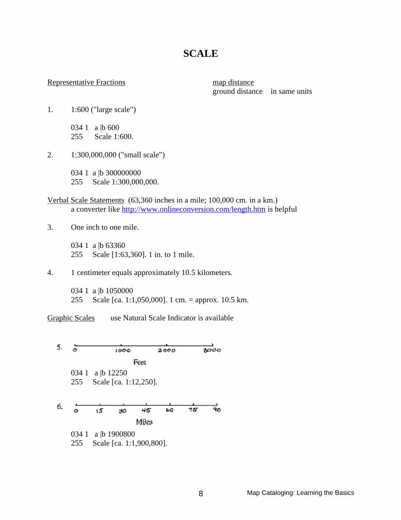
SCALE
Representative Fractions map distanceground distance in same units
1. 1:600 ("large scale")
034 1 a |b 600255 Scale 1:600.
2. 1:300,000,000 ("small scale")
034 1 a |b 300000000255 Scale 1:300,000,000.
Verbal Scale Statements (63,360 inches in a mile; 100,000 cm. in a km.)a converter like http://www.onlineconversion.com/length.htm is helpful
3. One inch to one mile.
034 1 a |b 63360255 Scale [1:63,360]. 1 in. to 1 mile.
4. 1 centimeter equals approximately 10.5 kilometers.
034 1 a |b 1050000255 Scale [ca. 1:1,050,000]. 1 cm. = approx. 10.5 km.
Graphic Scales use Natural Scale Indicator is available
034 1 a |b 12250255 Scale [ca. 1:12,250].
034 1 a |b 1900800255 Scale [ca. 1:1,900,800].

Map Cataloging: Learning the Basics9
Scale, p. 2
Some Combination of the Above
7.
034 1 a |b 1550000255 Scale 1:1,550,000. 1 cm. = 15.5 km. Or 1 in. = 24.5 miles.
Non-Representative Fraction Scale Statements
8. Scale varies
Use when the scale within a single map varies across the map and the outside values are notknown.
034 0 a255 Scale varies.
If the outside values are known, record both scales, connected by a hyphen.
034 3 a |b 19000 |b 33000255 Scale 1:19,000-1:33,000.
9. Scales differ
Use when there are three or more maps of equal importance on the sheet or in the set and theirscales are not the same.
034 0 a255 Scales differ.
When there are two or more maps of equal importance with only two different scales, twoscale statements are given. Give the larger scale first, unless the smaller scale is clearlypredominant or there are only two maps with no collective title. In the latter case, give the scalesin the order corresponding to the individual titles in the title area. (If all the information in themathematical data area is the same for two maps of equal importance, only one mathematicaldata area is given.)

Map Cataloging: Learning the Basics10
Scale, p. 3
034 1 a |b 25000034 1 a |b 30000255 Scale 1:25,000.255 Scale 1:30,000.
10. Scale not given
Use only when the only way to determine the scale is to compare the map with a map ofknown scale (see below) and the library's policy is not to do so.
034 0 a255 Scale not given.
11. Scale indeterminable
Use only when there is truly no way to determine the scale using one of the methodsdescribed here, including the use of the comparison method.
034 0 a255 Scale indeterminable.
12. Not drawn to scale
Use for bird's-eye views, map views, maps of imaginary places, celestial charts and othermaps with nonlinear scales which do not give scale information on the item and which are notdrawn to scale.
034 0 a255 Not drawn to scale.
Use of Latitude
Use a scale indicator, if available. If using a ruler, the formual is___n_____11,000,000
where n is the number of centimeters measured on the map for 10 latitude11,000,000 is the approximate number of centimeters on the ground for 10 latitude
To get the representative fraction, divide the numerator and the denominator by n, givingyou 1 to the left of the colon and 11,000,000/n to the right of the colon.

Map Cataloging: Learning the Basics11
Scale, p 4
13. __________________ 440
__________________ 450
034 1 a |b 5500000255 Scale [ca. 1:5,500,000].
On scale indicator (10 latitude): On ruler:10 mark crosses at about 5,500,000 2 cm. = 10
10 = 5,500,000 2/2 = 11,000,000/21:5,500,000 1:5,500,000When there is more than one degree latitude between lines, remember to multiply11,000,000 by the number of degrees represented before applying the formula.
14. ________________ 300
________________ 150
034 1 a |b 112500000Scale [ca. 1:112,500,000].
On scale indicator (10 latitude): On ruler:150 mark crosses at 7,500,000 1.5 cm. = 150
150 = 7,500,000 x 15 1.5 cm. = 15 x 11,000,0001: 112,500,000 1.5/1.5 = 165,000,000/1.5
1: 110,000,000(Note that both methods are only approximations; a difference of 2,500,000 at this small scale isnot very significant.)
Comparison with a Map of Known Scale--Choose a map of known scale that shares identifiable points with the map of unknown scale.--Measure the distance between two identifiable points on the map of known scale.--Measure the distance between the same two points on the map of unknown scale, using thesame unit of measurement.-- Apply the following equation: n=m x a/bwhere n is the denominator of the RF of the map of unknown scale
m is the denominator of the RF of the map of known scalea is the distance between the two points on the map of known scaleb is the distance between the two points on the map of unknown scale
This is the least accurate way of determining scale. The Library of Congress does not use thismethod of calculating scale.

Map Cataloging: Learning the Basics12
SCALE EXERCISES
1. One inch represents six miles
2. 1 centimeter on the map represents 20 kilometers on the ground
3. One inch equals approximately 40 miles or 64.4 kilometers
4. One inch: approximately 17.3 miles
8.

Map Cataloging: Learning the Basics13
Scale Exercises, p. 2
9. _______________________ 300
_______________________ 320
10. ______________________ 170
_______________________ 220
Map Cataloging: Learning the Basics14
PROJECTION AND COORDINATES
PROJECTION refers to the system used to represent information about the spherical surface of theEarth on a flat surface. There are many different types of projections. You don’t need to understand anyof them to catalog a map. Projection is not reflected in the 034, but is coded in the fixed fields.
Transcribe a statement of projection found on the map, its container or case, or accompanying printedmaterial in the mathematical data (255) area. Transcribe the statement in English, regardless of thelanguage in which it appears. Use standard abbreviations (e.g. “proj.” for “projection”) and numerals inplace of words. Capitalize proper names. (Cartographic Materials, 3C) (Note: The Map CatalogingManual says to capitalize the first word as well. OCLC documentation follows LC).
255 Scale 1:150,000 ; |b Transverse Mercator proj.
COORDINATES refer to the geographical grid lines used to pinpoint locations on the earth.– Longitude lines (or “meridians”) run north/south between the poles– Latitude lines (or “parallels”) run east/west parallel to the equator
Both sets of lines are measured in degrees, minutes, and seconds from a standard base line (the numberrepresents the angle measured between the subject line and the base line through the center of the earth).
For longitude, the standard base line (or “prime meridian”) is usually the line which passes throughGreenwich, England. However, any meridian can be used as a prime meridian. Older maps often havenon-Greenwich prime meridians and this is usually indicated on the map. Longitude is counted 1800 eastor west from the prime meridian. Record longitude from westernmost to easternmost points.
For latitude, the standard base line is the equator. Latitude is counted 900 north or south from the equator.Record latitude from northernmost to southernmost points.
Give the coordinates in the following order:westernmost extent, easternmost extent, northernmost extent, southernmost extent
Enter coordinates in the 034 field in the form HDDDMMSS (hemisphere, degrees, minutes, seconds,where hemisphere is W, E, N, or S as appropriate).
034 1 a |b 1000000 |dW1013015 |e W0203000 |f N0490000 |g N0343015255 Scale 1:1,000,000 |c (W 101030'15"–W 20030'00"/N 49000'00"–N 34030'15").
034 1 a |b 2000 |dW0745000 |e W0744000 |f N0450500 |g N 0450000255 Scale [ca. 1:2,000] |c (W 74050'–W 74040'/N 45005"–N 45000').
034 1 a |b 500000 |d E0790000 |e E0860000 |f N0200000 |g N0120000255 Scale 1:500,000 |c (E 790–E 860/N 200--N 120).
INPUTTING TIP: The correct symbols for degrees, minutes and seconds are special characters:Degrees: Superscript zeroMinutes (and feet): Miagkii znakSeconds (and inches): Tverdyi znak
Coordinates for the moon, planets, and other celestial bodies are given in a note.

Map Cataloging: Learning the Basics15
MEASURING EXAMPLES
1. 1 map : |b col. ; |c 20 x 27 cm.– Measure height x width rounded up to the nearest cm. (with map in reading position).
2. 1 map : |b col. ; |c 51 x 75 cm., folded to 23 x 11 cm.– Also give folded size if map is designed to be folded (has panel or cover).
3. 1 map : |b col. ; |c 58 x 48 cm.– If cartographic details extends beyond the neat line, include it in the measurement
4. 1 map ; |c 17 x 25 cm.– No neat line: measure cartographic extent, which could be the entire sheet.
5. 1 map : |b col. ; |c 20 x 27 cm., on sheet 43 x 28 cm., folded to 22 x 10 cm.– Also give sheet size if either dimension of map is less the half the same dimension of the sheet.
6. 1 map in 3 segments : |b col. ; |c 144 x 22 cm., on sheet 55 x 65 cm.– Map in segments at consistent scale: measure as if segments are joined; also give sheet size
7. 2 maps on 1 sheet : |b both sides, col. ; |c 32 x 49 cm. and 32 x 55 cm., on sheet 93 x 65 cm.,folded to 23 x 11 cm.– 2 maps of equal importance (collective title); measure both maps; also give sheet size
8. 1 map on 2 sheets : |b col. ; |c 121 x 194 cm., sheets 137 x 107 cm– Map on multiple sheets: measure as if sheets joined, excluding any overlap; also give sheet size
9. 3 maps on 1 sheet :|bboth sides, col. ;|c73 x 48 cm. or smaller on sheet 75 x 50 cm., folded to25 x 13 cm– 3 or more maps or sheets, give the greatest height of any of them followed by the greatestwidth of any of them, followed by “or smaller”
10. 1 map : |b both sides, col. ; |c 104 x 109 cm., on sheet 107 x 68 cm., folded to 23 x 11 cm.– 1 map continued on back: measure as if one map, excluding overlap; also give sheet size
11. 1 map : |b col. ; |c 43 x 62 cm., folded to 23 x 11 cm.– A continuation ancillary map is not included in measurement; mention it in a note (butcoordinates do take continuation into account)
12. 1 map : |b col. ; |c 69 cm. in diam., on sheet 74 x 74 cm.– Circular map: give diameter and label as such; also give sheet size
13. 1 map : |b col. ; |c on sheet 46 x 61 cm.– Map too difficult to measure: simply give sheet size.
Map Cataloging: Learning the Basics16
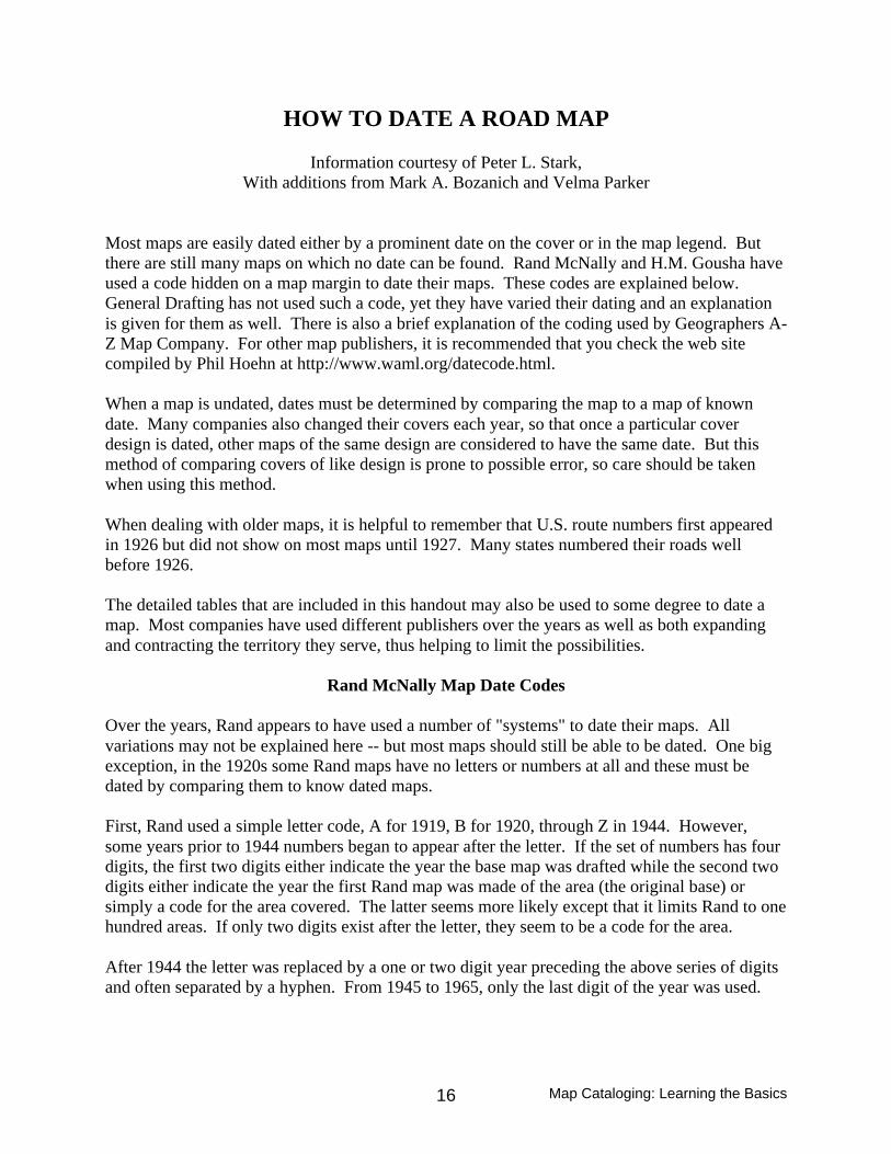
HOW TO DATE A ROAD MAP
Information courtesy of Peter L. Stark,With additions from Mark A. Bozanich and Velma Parker
Most maps are easily dated either by a prominent date on the cover or in the map legend. Butthere are still many maps on which no date can be found. Rand McNally and H.M. Gousha haveused a code hidden on a map margin to date their maps. These codes are explained below.General Drafting has not used such a code, yet they have varied their dating and an explanationis given for them as well. There is also a brief explanation of the coding used by Geographers A-Z Map Company. For other map publishers, it is recommended that you check the web sitecompiled by Phil Hoehn at http://www.waml.org/datecode.html.
When a map is undated, dates must be determined by comparing the map to a map of knowndate. Many companies also changed their covers each year, so that once a particular coverdesign is dated, other maps of the same design are considered to have the same date. But thismethod of comparing covers of like design is prone to possible error, so care should be takenwhen using this method.
When dealing with older maps, it is helpful to remember that U.S. route numbers first appearedin 1926 but did not show on most maps until 1927. Many states numbered their roads wellbefore 1926.
The detailed tables that are included in this handout may also be used to some degree to date amap. Most companies have used different publishers over the years as well as both expandingand contracting the territory they serve, thus helping to limit the possibilities.
Rand McNally Map Date Codes
Over the years, Rand appears to have used a number of "systems" to date their maps. Allvariations may not be explained here -- but most maps should still be able to be dated. One bigexception, in the 1920s some Rand maps have no letters or numbers at all and these must bedated by comparing them to know dated maps.
First, Rand used a simple letter code, A for 1919, B for 1920, through Z in 1944. However,some years prior to 1944 numbers began to appear after the letter. If the set of numbers has fourdigits, the first two digits either indicate the year the base map was drafted while the second twodigits either indicate the year the first Rand map was made of the area (the original base) orsimply a code for the area covered. The latter seems more likely except that it limits Rand to onehundred areas. If only two digits exist after the letter, they seem to be a code for the area.
After 1944 the letter was replaced by a one or two digit year preceding the above series of digitsand often separated by a hyphen. From 1945 to 1965, only the last digit of the year was used.
Map Cataloging: Learning the Basics17
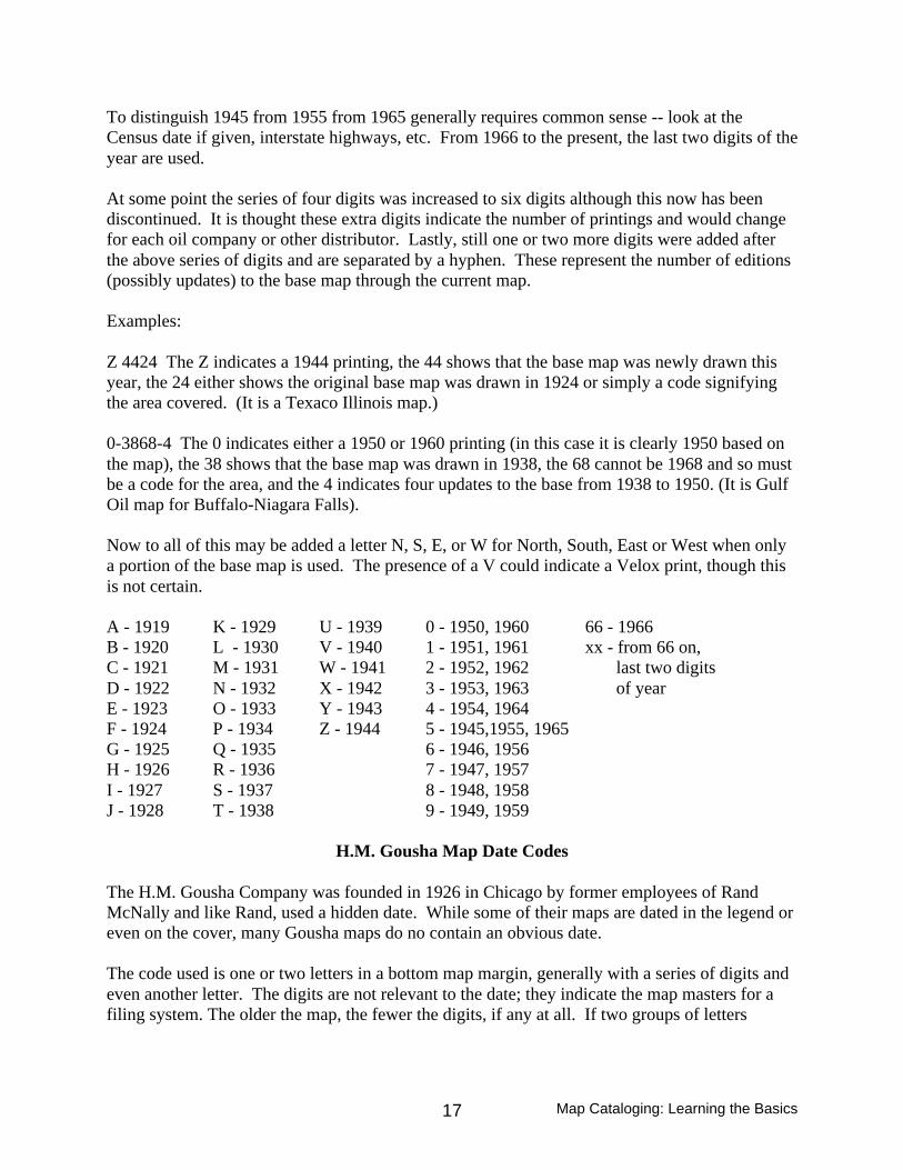
To distinguish 1945 from 1955 from 1965 generally requires common sense -- look at theCensus date if given, interstate highways, etc. From 1966 to the present, the last two digits of theyear are used.
At some point the series of four digits was increased to six digits although this now has beendiscontinued. It is thought these extra digits indicate the number of printings and would changefor each oil company or other distributor. Lastly, still one or two more digits were added afterthe above series of digits and are separated by a hyphen. These represent the number of editions(possibly updates) to the base map through the current map.
Examples:
Z 4424 The Z indicates a 1944 printing, the 44 shows that the base map was newly drawn thisyear, the 24 either shows the original base map was drawn in 1924 or simply a code signifyingthe area covered. (It is a Texaco Illinois map.)
0-3868-4 The 0 indicates either a 1950 or 1960 printing (in this case it is clearly 1950 based onthe map), the 38 shows that the base map was drawn in 1938, the 68 cannot be 1968 and so mustbe a code for the area, and the 4 indicates four updates to the base from 1938 to 1950. (It is GulfOil map for Buffalo-Niagara Falls).
Now to all of this may be added a letter N, S, E, or W for North, South, East or West when onlya portion of the base map is used. The presence of a V could indicate a Velox print, though thisis not certain.
A - 1919 K - 1929 U - 1939 0 - 1950, 1960 66 - 1966B - 1920 L - 1930 V - 1940 1 - 1951, 1961 xx - from 66 on,C - 1921 M - 1931 W - 1941 2 - 1952, 1962 last two digitsD - 1922 N - 1932 X - 1942 3 - 1953, 1963 of yearE - 1923 O - 1933 Y - 1943 4 - 1954, 1964F - 1924 P - 1934 Z - 1944 5 - 1945,1955, 1965G - 1925 Q - 1935 6 - 1946, 1956H - 1926 R - 1936 7 - 1947, 1957I - 1927 S - 1937 8 - 1948, 1958J - 1928 T - 1938 9 - 1949, 1959
H.M. Gousha Map Date Codes
The H.M. Gousha Company was founded in 1926 in Chicago by former employees of RandMcNally and like Rand, used a hidden date. While some of their maps are dated in the legend oreven on the cover, many Gousha maps do no contain an obvious date.
The code used is one or two letters in a bottom map margin, generally with a series of digits andeven another letter. The digits are not relevant to the date; they indicate the map masters for afiling system. The older the map, the fewer the digits, if any at all. If two groups of letters

Map Cataloging: Learning the Basics18
appear in the series, check both and use the one that makes the most sense based on the map.Occasionally, a map code may indicate different dates on each side of the map or with aparticular inset. In this case the map is classified by the newest such date.
Letter A was assigned to 1927, B to 1928, and so forth through Z in 1952. Then AA for 1953,BB for 1954 and so forth through ZZ in 1978. At this point the code gets confusing, refer to thetable below.
A - 1927 M - 1939 Y - 1951 KK - 1963 WW - 1975 QD - 1987B - 1928 N - 1940 Z - 1952 LL - 1964 XX - 1976 WJ - 1988C - 1929 O - 1941 AA - 1953 MM - 1965 YY - 1977 ER - 1989D - 1930 P - 1942 BB - 1954 NN - 1966 ZZ - 1978 IV - 1990E - 1931 Q - 1943 CC - 1955 OO - 1967 AB - 1979 SF - 1991F - 1932 R - 1944 DD - 1956 PP - 1968 AC - 1980 UH - 1992G - 1933 S - 1945 EE - 1957 QQ - 1969 AN - 1981 GT - 1993H - 1934 T - 1946 FF - 1958 RR - 1970 MZ - 1982I - 1935 U - 1947 GG - 1959 SS - 1971 OB - 1983J - 1936 V - 1948 HH - 1960 TT - 1972 YL - 1984K - 1937 W - 1949 II - 1961 UU - 1973 CP - 1985L - 1938 X - 1950 JJ - 1962 VV - 1974 KX - 1986
All maps published after 1987 have the edition year on the copyright statement.
General Drafting Date Codes
General Drafting has not used a date code in the sense of Rand or Gousha. If any problem existswith GD it is that they use too many dates. The exception is some maps from the 1920s arecompletely undated and can only be dated by comparing with maps of known date.
If a date is shown on the cover or in the legend, then that is the date to use. When two dates aregiven, such as 1955-1956 or 1970-71, then always use the first year. Many maps also have acopyright date which is frequently one year earlier than the legend date, in this case use thelegend date. However, if the copyright date is the only date, then use the copyright date.
In the 1960s, the legend frequently contained a month in addition to the year. In these cases,from January through August, use the year given; but for September through December, use thenext year. This is basically the system GD uses and it will result in common cover designs beingcalled the same year. (This applies to the years 1962-1966 in the detailed map listings.)
Due to reprintings, it is possible for the same map to exist as 1970 and 1970-71 and similarly forother years. These are not listed as separate dates but, in this example, only as 1970.

Map Cataloging: Learning the Basics19
Since the 1940s, most GD maps contain three or four small digits plus a letter in the margin or onthe back cover. This is the month and year of printing and should not be used to date the mapunless nothing else exists. These change for each reprinting. The letter indicates the printingcompany. The only one known for sure is W for Western Publishing and Printing Company.
All of the above explains how to determine the date on which the map was issued. But sinceabout 1958, GD has used a code to date the masters from which the map was created. This dateis coded as a small "A" plus a number in a bottom corner of a map. This number indicates theyear the base map was first drafted. It is not updated unless the base is redrawn. A1 was for1953. The following table is for quick reference, but IS NOT THE DATE THE MAP WASISSUED.
A1 - 1953 A7 - 1959 A13- 1965 A19 - 1971 A25 - 1977A2 - 1954 A8 - 1960 A14 - 1966 A20 - 1972 A26 - 1978A3 - 1955 A9 - 1961 A15 -1967 A21 - 1973 A27 -1979A4 - 1956 A10 - 1962 A16 - 1968 A22 - 1974 A28 -1980A5 - 1957 A11 - 1963 A17 - 1969 A23 - 1975 A29 - 1981A6 - 1958 A12 - 1964 A18 - 1970 A24 - 1976 A30 - 1982
Geographers A-Z Map Company
The codes used by the Geographers A-Z Map Company are located in or near the border at onecorner of the map. Atlases produced by the company are coded differently and this table shouldnot be used for them. The code is comprised of three letters, with each letter corresponding to adifferent digit. The letters and their corresponding digit are:
J I H G F E D C B A1 2 3 4 5 6 7 8 9 0
Thus, "FDC" as a code would translate into "578" or May 1978.

Map Cataloging: Learning the Basics20
SUBJECT HEADINGS FOR CARTOGRAPHIC MATERIALS
Major tools: Library of Congress Subject Headings (LCSH)Subject Cataloging Manual (SCM)Map Cataloging Manual (MCM)
1. Basic subject assignment (MCM Chapter 4)A. The first subject heading and the classification number should match.
Exception: Classification can be broader than the first subject. This happenswhen multiple places are represented on the map so that the first "group" ofsubject headings represent the primary subject but the classification number is forthe broader area representing it.
B. Every map of an identifiable place must be assigned a subject heading for that area.
C. Peripheral places may be ignored. For instance, maps of the state of Washington oftenhave portions of Idaho and/or Oregon on the map. These peripheral areas may bedisregarded unless deemed important.
D. Subject analysis represents what the item is as opposed to what it says it is. If a mapclaims to be a road map but in actually is a tourist map, use Maps, Tourist.
E. Add topic subjects that get at the general subject matter of the maps or the subjectmatter of the textual material on the map. For instance, for Sanborn insurance maps youmay want to add a subject heading like: Insurance, Fire -- [Place]-- MapsOther examples: Reclamation of land -- [Place] -- Maps Sewage -- [Place] -- Maps Roads -- [Place] -- Maps
2. Free-floating subdivisionsA. Form Subdivisions for use under names of places (SCM H1140)
The most commonly used form subdivisions for maps are:Aerial views (see SCM H1210.5 for further explanation)Bathymetric mapsHistorical geography -- MapsIndex mapsMapsMaps, Outline and baseMaps, PhysicalMaps, PictorialMaps, TopographicMaps, TouristRemote-sensing maps

Map Cataloging: Learning the Basics21
B. Free-floating additions to names of places
Metropolitan Area (use with names of cities) (SCM H790 & MCM Ch. 4) Suburban Area (use with names of cities) (SCM H790 & MCM Ch. 4)Region (use with names of cities & geographic features) (SCM H760)
C. Special cases
There are a number of special cases where specific sets of subject headings arerequired. These are found in the MCM Chapter 4. In addition to detailing thespecific subject headings to be used for particular kinds of maps, it also detailshow subject access to ancillary maps, inserts, and subsidiary maps should behandled and includes information about particular classification practices.
Some examples of these special cases are:Bicycle mapsTourist mapsNautical chartsRailroads
D. National forests
There are particular problems with the names of National forests. Theinstructions for these materials are in MCM Chapter 1. The main thing toremember is administrative names for the forests are not the official names.Because the official names of these forests need Congressional approval to bechanged, they are not changed when their administrative names change.
III. Atlases
A. Assign map subject headings to all atlases. However, only assign map subjectheading(s) to a book that includes maps if more than 20% of the item consists of maps(SCM H1865).
B. World atlases - use Atlases for world atlases published in the United States. UseAtlases, [country] for world atlases published in other countries, where the countryqualifier is the name of the country of publication.
Map Cataloging: Learning the Basics22
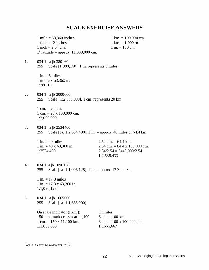
SCALE EXERCISE ANSWERS
1 mile = 63,360 inches 1 km. = 100,000 cm.1 foot = 12 inches 1 km. = 1,000 m.1 inch = 2.54 cm. 1 m. = 100 cm.10 latitude = approx. 11,000,000 cm.
1. 034 1 a |b 380160255 Scale [1:380,160]. 1 in. represents 6 miles.
1 in. = 6 miles1 in = 6 x 63,360 in.1:380,160
2. 034 1 a |b 2000000255 Scale {1:2,000,000]. 1 cm. represents 20 km.
1 cm. = 20 km.1 cm. = 20 x 100,000 cm.1:2,000,000
3. 034 1 a |b 2534400255 Scale [ca. 1:2,534,400]. 1 in. = approx. 40 miles or 64.4 km.
1 in. = 40 miles 2.54 cm. = 64.4 km.1 in. = 40 x 63,360 in. 2.54 cm. = 64.4 x 100,000 cm.1:2534,400 2.54/2.54 = 6440,000/2.54
1:2,535,433
4. 034 1 a |b 1096128255 Scale [ca. 1:1,096,128]. 1 in. ; approx. 17.3 miles.
1 in. = 17.3 miles1 in. = 17.3 x 63,360 in.1:1,096,128
5. 034 1 a |b 1665000255 Scale [ca. 1:1,665,000].
On scale indicator (l km.): On ruler:150-km. mark crosses at 11,100 6 cm. = 100 km.1 cm. = 150 x 11,100 km. 6 cm. = 100 x 100,000 cm.1:1,665,000 1:1666,667
Scale exercise answers, p. 2

Map Cataloging: Learning the Basics23
6. 034 1 a |b 253440255 Scale [ca. 1:253,440].
On scale indicator (1 mile): On ruler:4-mile mark crosses at 63,360 1 in. = 4 miles1 in. = 4 x 63,360 in. 1 in. = 4 x 63,360 in.1:253,440 1:253,440
7. 034 1 a |b 5900255 Scale [ca. 1:5,900].
On scale indicator (1000 ft.): On ruler:1000-foot mark crosses at 5900 1 in = approx. 500 ft.1:5,900 1 in = 500 x 12 in.
1:6,000
8. 034 1 a |b 2025000255 Scale [ca. 1:2,025,000] not "1:1,550,000" ; Lambert conformal conic proj.,standard parallels 47055' and 59035'.
On scale indicator (1 mile): On ruler:75-mile mark crosses at 27,000 2.4 cm. = 50 km.1 mile = 27,000 x 75 miles 2.4 cm. = 50 x 100,000 cm.1:2,025,000 2.4/2.4 = 5,000,000/2.4
1:2,083,333
9. 034 1 a |b 6500000255 Scale [ca. 1: 6,500,000].
On scale indicator (10 latitude): On ruler:2 0 mark crosses at 3,250,000 3.4 cm. = 20
10 = 3,250,000 x 2 3.4 cm. = 2 x 11,000,000 cm.1:6,500,000 3.4/3.4 = 22,000,000/3.4
1:6,470,588
10. 034 1 a |b 28000000255 Scale [ca. 1:28,000,000].
On scale indicator (10 latitude): On ruler:50 mark crosses at 5,600,000 1.95 cm. = 50
10 = 5,600,000 x 5 1.95 cm. = 5 x 11,000,000 cm.1:28,000,000 1.95/1.95 = 55,000,000/1.95
1:28,205,128