mapping distribution by_qgis_20141202
TRANSCRIPT
Mapping distribution by QGIS
CTH
20141202

Workshop goals
• Mapping the distribution of Broussonetia papyrifera in Taiwan
• With elevation and outline
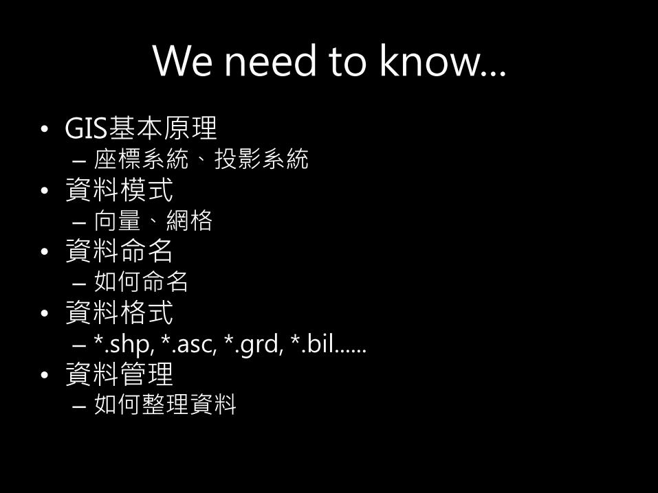
We need to know...
• GIS基本原理– 座標系統、投影系統
• 資料模式– 向量、網格
• 資料命名– 如何命名
• 資料格式– *.shp, *.asc, *.grd, *.bil......
• 資料管理– 如何整理資料

We need to know... (2)
• QGIS介面
• 瀏覽器(catalog)
• 資料載入
• 資料處理
– 設定參考座標
– 查詢
– 裁切
• 結果輸出

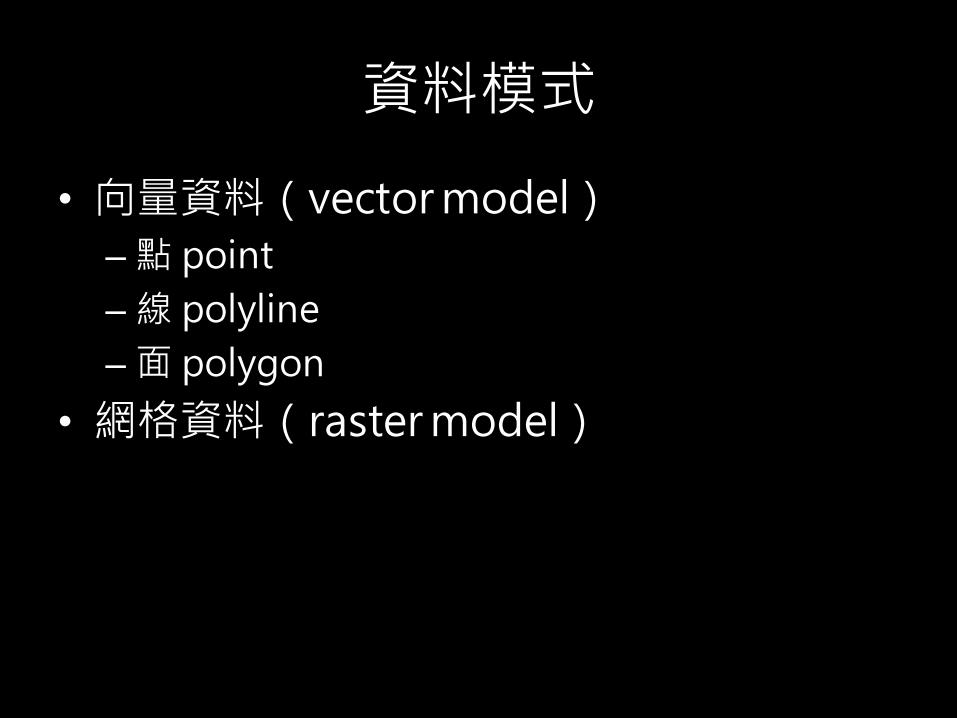
資料模式
• 向量資料(vector model)
– 點 point
– 線 polyline
– 面 polygon
• 網格資料(raster model)

資料模式
• 向量資料(vector model)
– 點 point
– 線 polyline
– 面 polygon

資料模式
• 網格資料(raster model)
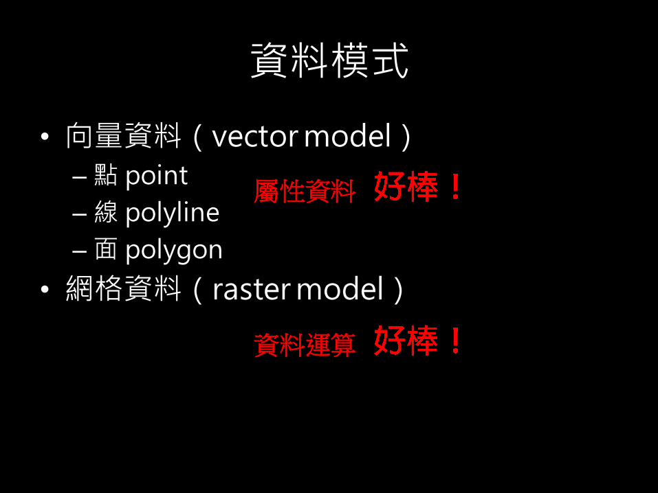
資料模式
• 向量資料(vector model)
– 點 point
– 線 polyline
– 面 polygon
• 網格資料(raster model)
屬性資料
資料運算
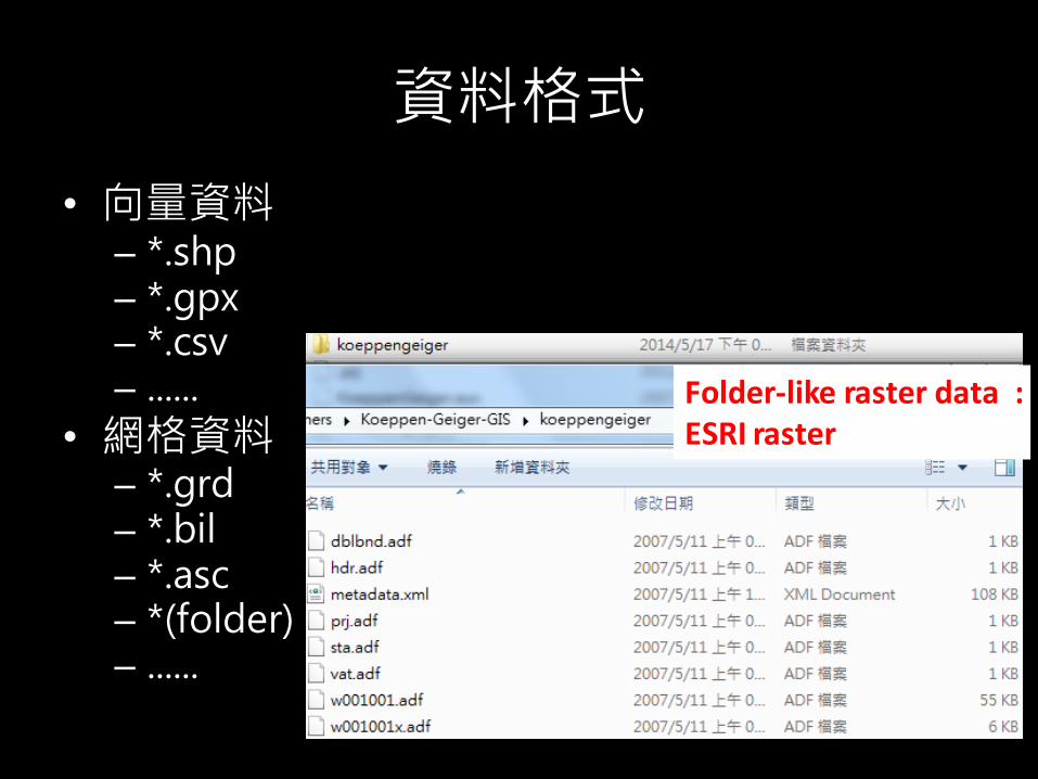
資料格式
• 向量資料– *.shp– *.gpx– *.csv– ......
• 網格資料– *.grd– *.bil– *.asc – *(folder)– ......
Folder-like raster data : ESRI raster
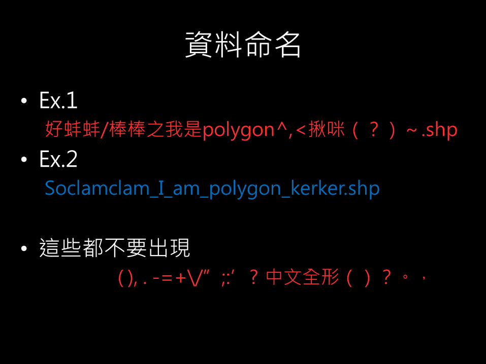
資料命名
• Ex.1
好蚌蚌/棒棒之我是polygon^,<揪咪(?)~.shp
• Ex.2
Soclamclam_I_am_polygon_kerker.shp
• 這些都不要出現
( ), . -=+\/”;:’? 中文全形()?。,

資料管理
• 檔名有點長沒關係,清楚、詳細最重要!
• 資料放在同一個資料夾或他的子資料夾
– 檔案才找得到!
• 同一資料夾下,檔名相同、副檔名不同的檔案是代表同一個GIS檔案
• 盡可能用瀏覽器(QGIS)/catalog(arcGIS)操作檔案
We already know...
• GIS基本原理– 座標系統、投影系統
• 資料模式– 向量、網格
• 資料命名– 如何命名
• 資料格式– *.shp, *.asc, *.grd, *.bil......
• 資料管理– 如何整理資料
We need to know... (2)
• QGIS介面
• 瀏覽器(catalog)
• 資料載入
• 資料處理
– 設定參考座標
– 查詢
– 裁切
• 結果輸出


QGIS介面
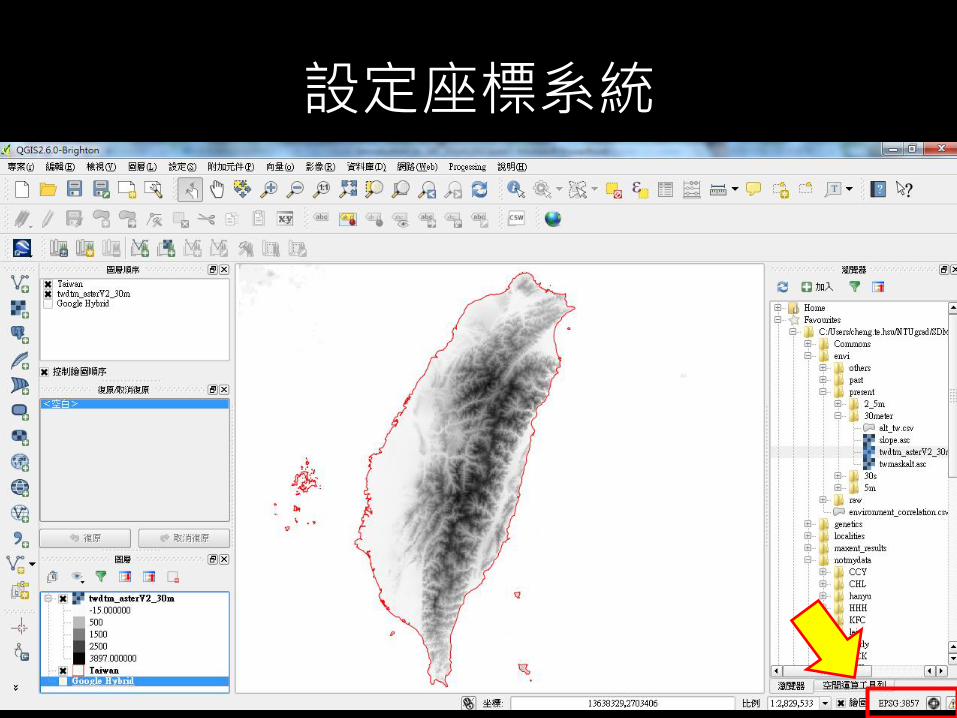
設定座標系統
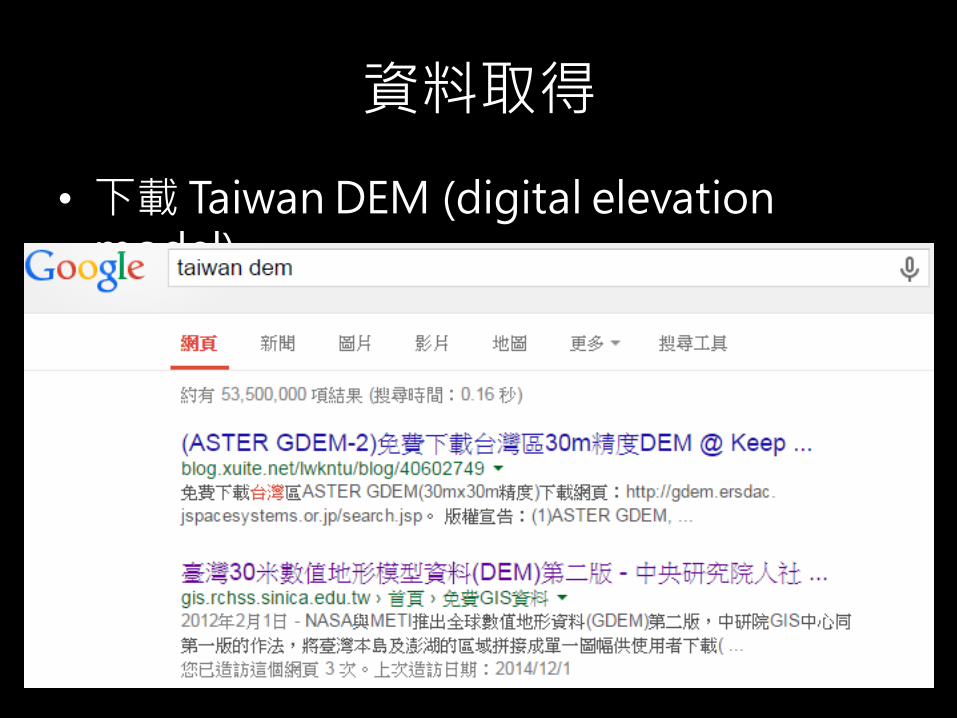
資料取得
• 下載 Taiwan DEM (digital elevation model)

資料取得
• 解壓縮”20120201_twdtm_assterV2_30m.rar”中的”tif file”在同一資料夾 (ex: D:/test/) 中
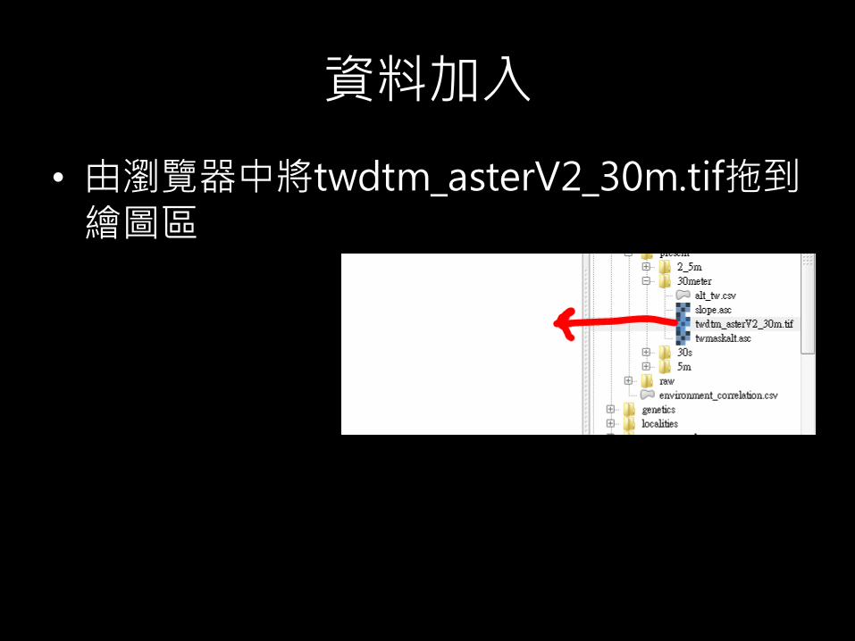
資料加入
• 由瀏覽器中將twdtm_asterV2_30m.tif拖到繪圖區

資料加入
• 好醜,等等再說...加入位點資料吧!

位點資料加入
• *.xls轉存成*.csv
• 資料抬頭的重要性

位點資料加入
• 圖層>加入圖層>加入分隔文字圖層

位點資料加入
• 注意!
– 編碼
– X field
– Y field

位點資料加入
• 有fu~

位點資料加入
• 只要台灣的範圍就好怎麼辦呢?

加入國界向量資料
• 加入country_gdam2.shp
• 開啟屬性表格,選擇「Taiwan」的那一列
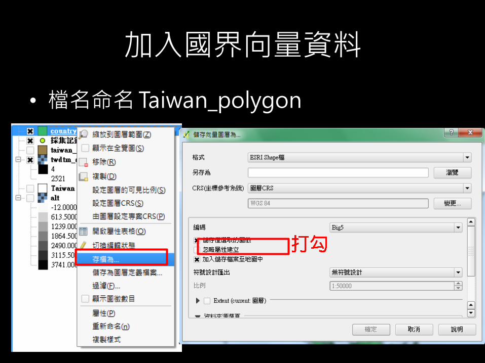
加入國界向量資料
• 檔名命名 Taiwan_polygon
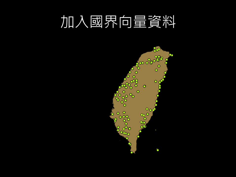
加入國界向量資料

擷取台灣的DEM資料
• 只要台灣島內的DEM資料
• 作法
– 用台灣國界的polygon剪台灣DEM網格

擷取台灣的DEM資料
• 輸出...*.bil(好了...)
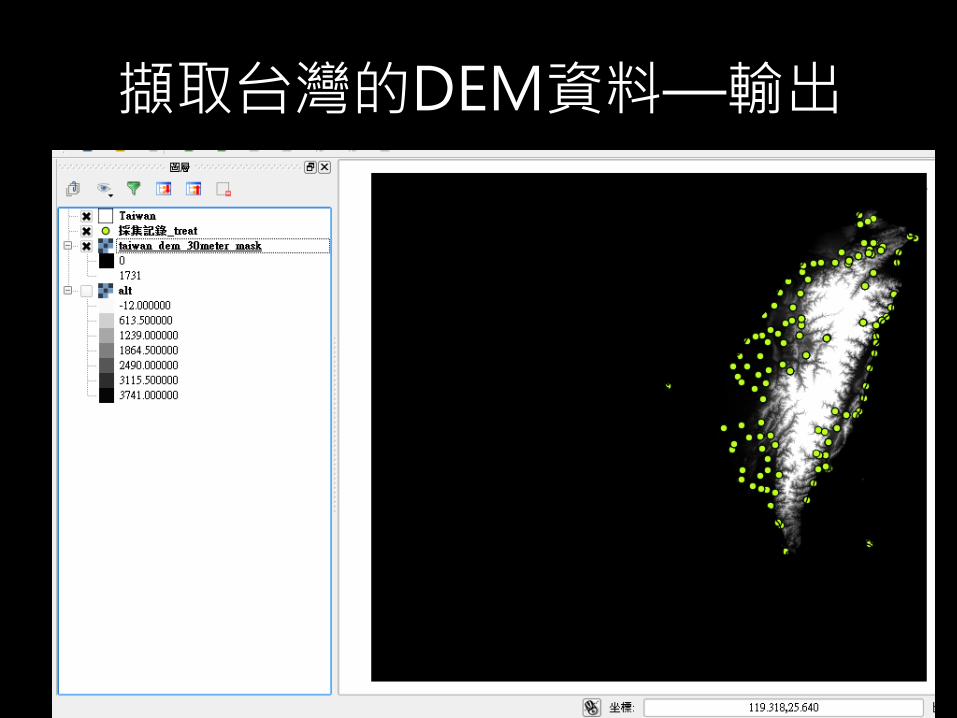
擷取台灣的DEM資料—輸出
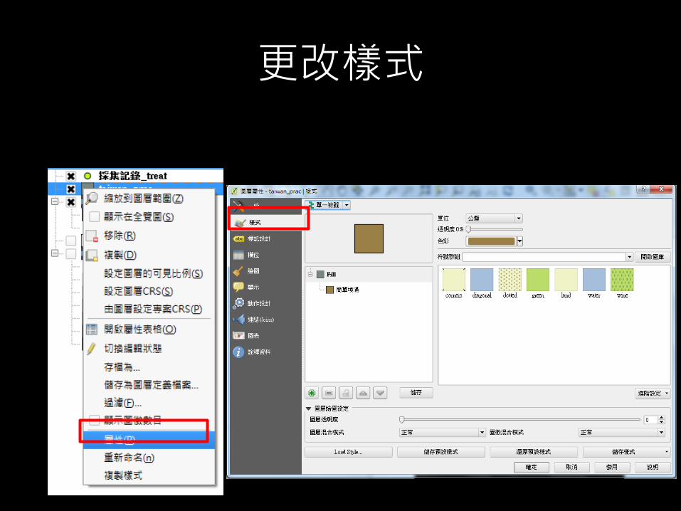
更改樣式


圖層堆疊順序
• 檢視>版面配置>圖層順序

準備出圖
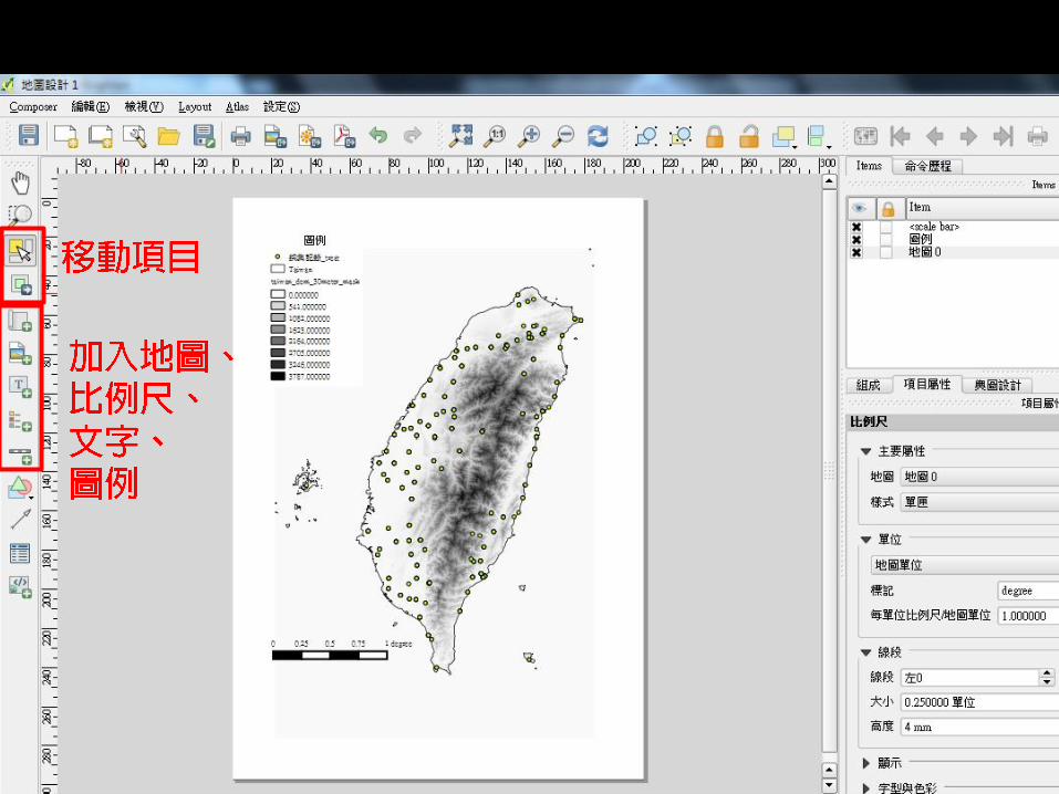
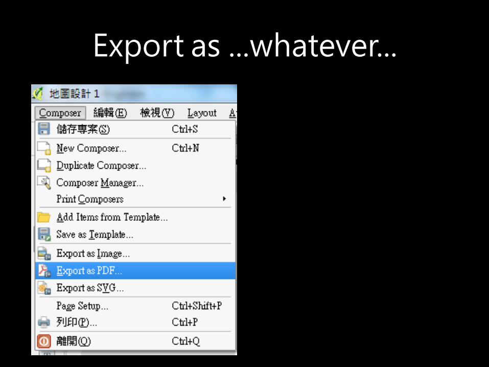
Export as ...whatever...

有用的網站
• QGIS第三講—地圖展示與匯出--psilotum
– http://www.slideshare.net/mutolisp/qgis3
• Quantum GIS資源網@Sinica
– http://gis.rchss.sinica.edu.tw/qgis/